You are here: Home > Network List > GS - US Geological Survey Networks Stations List
> Station DEC06 Boomer, Decatur, IL, USA > Earthquake Result Viewer
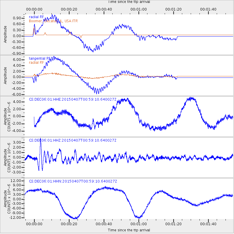
DEC06 Boomer, Decatur, IL, USA - Earthquake Result Viewer
*The percent match for this event was below the threshold and hence no stack was calculated.
| Earthquake location: |
Tonga Islands |
| Earthquake latitude/longitude: |
-15.2/-173.2 |
| Earthquake time(UTC): |
2015/04/07 (097) 00:46:18 GMT |
| Earthquake Depth: |
10 km |
| Earthquake Magnitude: |
5.8 MB |
| Earthquake Catalog/Contributor: |
NEIC PDE/NEIC ALERT |
|
| Network: |
GS US Geological Survey Networks |
| Station: |
DEC06 Boomer, Decatur, IL, USA |
| Lat/Lon: |
39.90 N/88.95 W |
| Elevation: |
215 m |
|
| Distance: |
95.3 deg |
| Az: |
50.243 deg |
| Baz: |
254.748 deg |
| Ray Param: |
$rayparam |
*The percent match for this event was below the threshold and hence was not used in the summary stack. |
|
| Radial Match: |
84.163506 % |
| Radial Bump: |
400 |
| Transverse Match: |
71.19049 % |
| Transverse Bump: |
400 |
| SOD ConfigId: |
872571 |
| Insert Time: |
2015-04-21 01:01:30.561 +0000 |
| GWidth: |
2.5 |
| Max Bumps: |
400 |
| Tol: |
0.001 |
|
Signal To Noise
| Channel | StoN | STA | LTA |
| GS:DEC06:01:HHZ:20150407T00:59:10.640027Z | 9.02243 | 1.5381971E-6 | 1.704859E-7 |
| GS:DEC06:01:HHN:20150407T00:59:10.640027Z | 2.0071542 | 7.4013788E-6 | 3.6874985E-6 |
| GS:DEC06:01:HHE:20150407T00:59:10.640027Z | 2.3619945 | 2.976661E-6 | 1.260232E-6 |
| Arrivals |
| Ps | |
| PpPs | |
| PsPs/PpSs | |


