
INCN Inchon, Republic of Korea - Earthquake Result Viewer
| ||||||||||||||||||
| ||||||||||||||||||
| ||||||||||||||||||
|
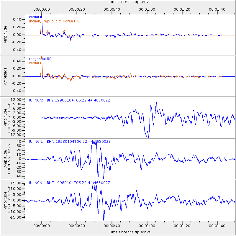
Signal To Noise
| Channel | StoN | STA | LTA |
| IU:INCN: :BHN:19980104T06:22:44.465002Z | 4.9663677 | 1.920284E-6 | 3.8665763E-7 |
| IU:INCN: :BHE:19980104T06:22:44.465002Z | 1.8278764 | 6.882723E-7 | 3.7654203E-7 |
| IU:INCN: :BHZ:19980104T06:22:44.465002Z | 1.5887631 | 4.7585775E-7 | 2.995146E-7 |
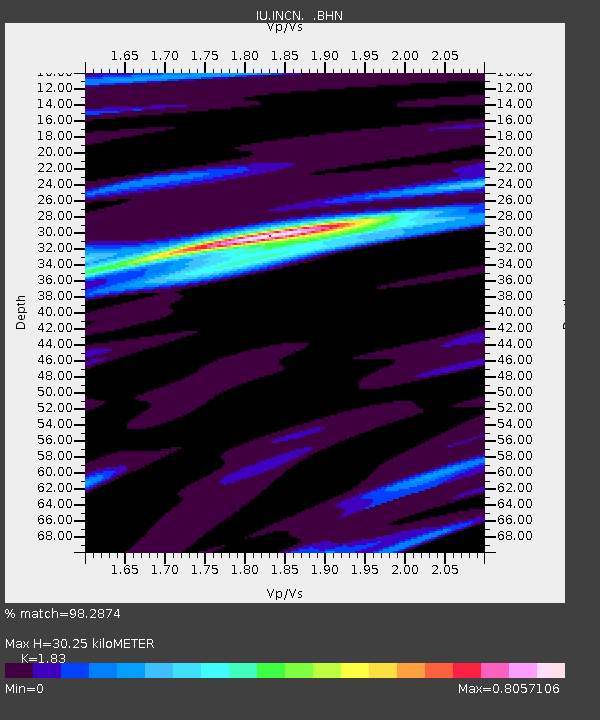
| Arrivals | |
| Ps | 4.0 SECOND |
| PpPs | 13 SECOND |
| PsPs/PpSs | 17 SECOND |

