You are here: Home > Network List > US - United States National Seismic Network Stations List
> Station CBKS Cedar Bluff, Kansas, USA > Earthquake Result Viewer
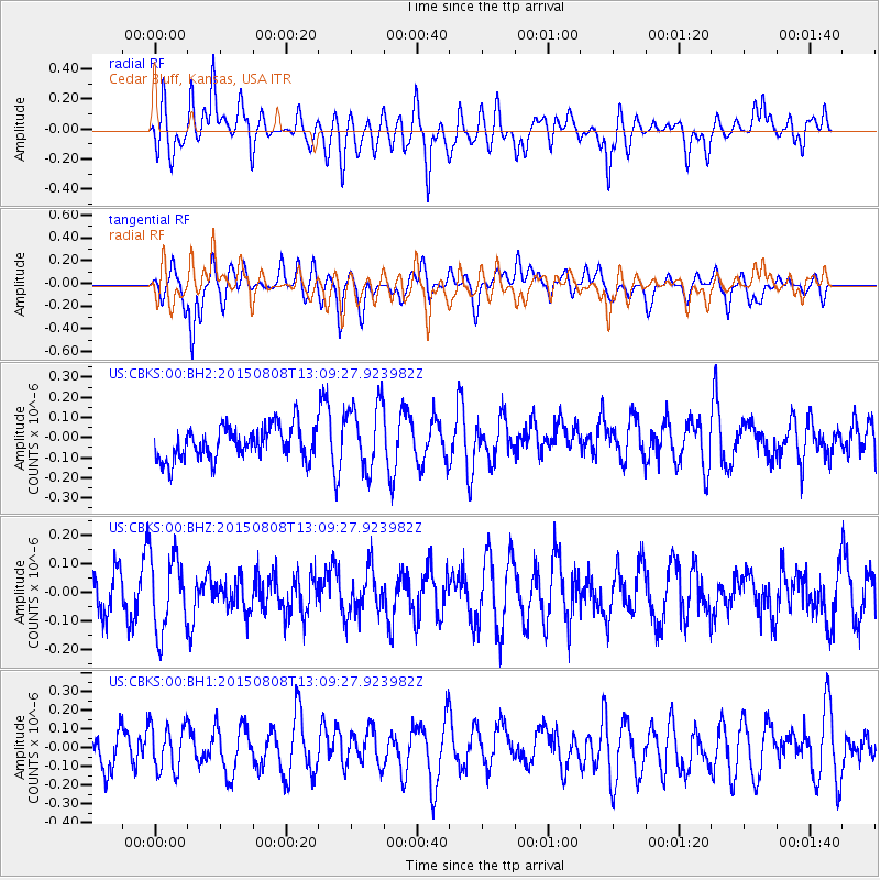
CBKS Cedar Bluff, Kansas, USA - Earthquake Result Viewer
*The percent match for this event was below the threshold and hence no stack was calculated.
| Earthquake location: |
Hokkaido, Japan Region |
| Earthquake latitude/longitude: |
43.0/145.8 |
| Earthquake time(UTC): |
2015/08/08 (220) 12:57:58 GMT |
| Earthquake Depth: |
39 km |
| Earthquake Magnitude: |
4.5 mb |
| Earthquake Catalog/Contributor: |
ISC/ISC |
|
| Network: |
US United States National Seismic Network |
| Station: |
CBKS Cedar Bluff, Kansas, USA |
| Lat/Lon: |
38.81 N/99.74 W |
| Elevation: |
677 m |
|
| Distance: |
79.2 deg |
| Az: |
46.391 deg |
| Baz: |
317.174 deg |
| Ray Param: |
$rayparam |
*The percent match for this event was below the threshold and hence was not used in the summary stack. |
|
| Radial Match: |
56.261013 % |
| Radial Bump: |
400 |
| Transverse Match: |
54.975426 % |
| Transverse Bump: |
400 |
| SOD ConfigId: |
7422571 |
| Insert Time: |
2019-04-20 06:04:35.437 +0000 |
| GWidth: |
2.5 |
| Max Bumps: |
400 |
| Tol: |
0.001 |
|
Signal To Noise
| Channel | StoN | STA | LTA |
| US:CBKS:00:BHZ:20150808T13:09:27.923982Z | 1.8315022 | 1.3537282E-7 | 7.391355E-8 |
| US:CBKS:00:BH1:20150808T13:09:27.923982Z | 1.2184405 | 1.2524984E-7 | 1.027952E-7 |
| US:CBKS:00:BH2:20150808T13:09:27.923982Z | 2.0197563 | 1.644233E-7 | 8.14075E-8 |
| Arrivals |
| Ps | |
| PpPs | |
| PsPs/PpSs | |


