You are here: Home > Network List > TA - USArray Transportable Network (new EarthScope stations) Stations List
> Station L04D Klamath Falls, OR, USA > Earthquake Result Viewer
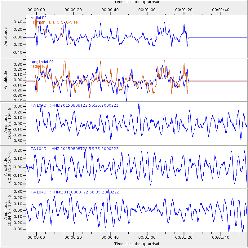
L04D Klamath Falls, OR, USA - Earthquake Result Viewer
*The percent match for this event was below the threshold and hence no stack was calculated.
| Earthquake location: |
Kuril Islands |
| Earthquake latitude/longitude: |
48.2/153.6 |
| Earthquake time(UTC): |
2015/08/08 (220) 22:47:37 GMT |
| Earthquake Depth: |
150 km |
| Earthquake Magnitude: |
4.2 mb |
| Earthquake Catalog/Contributor: |
ISC/ISC |
|
| Network: |
TA USArray Transportable Network (new EarthScope stations) |
| Station: |
L04D Klamath Falls, OR, USA |
| Lat/Lon: |
42.22 N/122.30 W |
| Elevation: |
1437 m |
|
| Distance: |
56.7 deg |
| Az: |
62.128 deg |
| Baz: |
307.251 deg |
| Ray Param: |
$rayparam |
*The percent match for this event was below the threshold and hence was not used in the summary stack. |
|
| Radial Match: |
41.01513 % |
| Radial Bump: |
400 |
| Transverse Match: |
41.949543 % |
| Transverse Bump: |
400 |
| SOD ConfigId: |
7422571 |
| Insert Time: |
2019-04-20 06:13:13.680 +0000 |
| GWidth: |
2.5 |
| Max Bumps: |
400 |
| Tol: |
0.001 |
|
Signal To Noise
| Channel | StoN | STA | LTA |
| TA:L04D: :HHZ:20150808T22:56:35.200022Z | 2.0087163 | 1.1339873E-7 | 5.6453327E-8 |
| TA:L04D: :HHN:20150808T22:56:35.200022Z | 0.93116504 | 1.0844009E-7 | 1.1645636E-7 |
| TA:L04D: :HHE:20150808T22:56:35.200022Z | 0.71616226 | 8.566785E-8 | 1.1962072E-7 |
| Arrivals |
| Ps | |
| PpPs | |
| PsPs/PpSs | |


