You are here: Home > Network List > TA - USArray Transportable Network (new EarthScope stations) Stations List
> Station L04D Klamath Falls, OR, USA > Earthquake Result Viewer
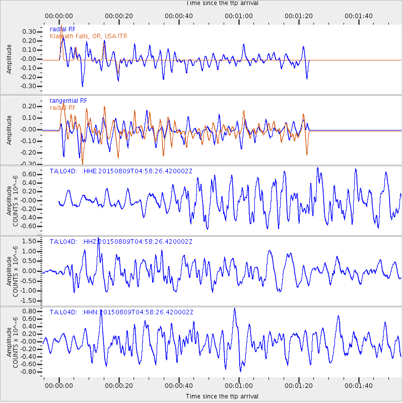
L04D Klamath Falls, OR, USA - Earthquake Result Viewer
*The percent match for this event was below the threshold and hence no stack was calculated.
| Earthquake location: |
Kermadec Islands Region |
| Earthquake latitude/longitude: |
-27.4/-176.1 |
| Earthquake time(UTC): |
2015/08/09 (221) 04:46:20 GMT |
| Earthquake Depth: |
10 km |
| Earthquake Magnitude: |
5.9 MWP |
| Earthquake Catalog/Contributor: |
NEIC PDE/NEIC COMCAT |
|
| Network: |
TA USArray Transportable Network (new EarthScope stations) |
| Station: |
L04D Klamath Falls, OR, USA |
| Lat/Lon: |
42.22 N/122.30 W |
| Elevation: |
1437 m |
|
| Distance: |
85.2 deg |
| Az: |
36.977 deg |
| Baz: |
226.042 deg |
| Ray Param: |
$rayparam |
*The percent match for this event was below the threshold and hence was not used in the summary stack. |
|
| Radial Match: |
77.97594 % |
| Radial Bump: |
400 |
| Transverse Match: |
74.557434 % |
| Transverse Bump: |
400 |
| SOD ConfigId: |
7422571 |
| Insert Time: |
2019-04-20 06:21:32.733 +0000 |
| GWidth: |
2.5 |
| Max Bumps: |
400 |
| Tol: |
0.001 |
|
Signal To Noise
| Channel | StoN | STA | LTA |
| TA:L04D: :HHZ:20150809T04:58:26.420002Z | 2.1877954 | 2.230712E-7 | 1.0196163E-7 |
| TA:L04D: :HHN:20150809T04:58:26.420002Z | 1.9053173 | 1.5781245E-7 | 8.282738E-8 |
| TA:L04D: :HHE:20150809T04:58:26.420002Z | 1.3924699 | 1.636702E-7 | 1.17539486E-7 |
| Arrivals |
| Ps | |
| PpPs | |
| PsPs/PpSs | |


