You are here: Home > Network List > US - United States National Seismic Network Stations List
> Station DGMT Dagmar, Montana, USA > Earthquake Result Viewer
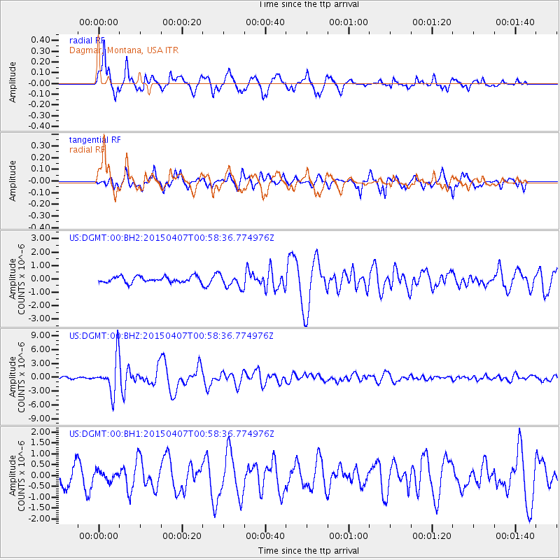
DGMT Dagmar, Montana, USA - Earthquake Result Viewer
*The percent match for this event was below the threshold and hence no stack was calculated.
| Earthquake location: |
Tonga Islands |
| Earthquake latitude/longitude: |
-15.2/-173.2 |
| Earthquake time(UTC): |
2015/04/07 (097) 00:46:18 GMT |
| Earthquake Depth: |
10 km |
| Earthquake Magnitude: |
5.8 MB |
| Earthquake Catalog/Contributor: |
NEIC PDE/NEIC ALERT |
|
| Network: |
US United States National Seismic Network |
| Station: |
DGMT Dagmar, Montana, USA |
| Lat/Lon: |
48.47 N/104.20 W |
| Elevation: |
0.0 m |
|
| Distance: |
88.0 deg |
| Az: |
38.448 deg |
| Baz: |
244.432 deg |
| Ray Param: |
$rayparam |
*The percent match for this event was below the threshold and hence was not used in the summary stack. |
|
| Radial Match: |
90.16103 % |
| Radial Bump: |
400 |
| Transverse Match: |
72.894806 % |
| Transverse Bump: |
375 |
| SOD ConfigId: |
872571 |
| Insert Time: |
2015-04-21 01:07:10.517 +0000 |
| GWidth: |
2.5 |
| Max Bumps: |
400 |
| Tol: |
0.001 |
|
Signal To Noise
| Channel | StoN | STA | LTA |
| US:DGMT:00:BHZ:20150407T00:58:36.774976Z | 19.28767 | 3.950597E-6 | 2.04825E-7 |
| US:DGMT:00:BH1:20150407T00:58:36.774976Z | 0.5919152 | 2.1309748E-7 | 3.6001353E-7 |
| US:DGMT:00:BH2:20150407T00:58:36.774976Z | 2.2855608 | 5.03502E-7 | 2.2029691E-7 |
| Arrivals |
| Ps | |
| PpPs | |
| PsPs/PpSs | |


