INCN Inchon, Republic of Korea - Earthquake Result Viewer
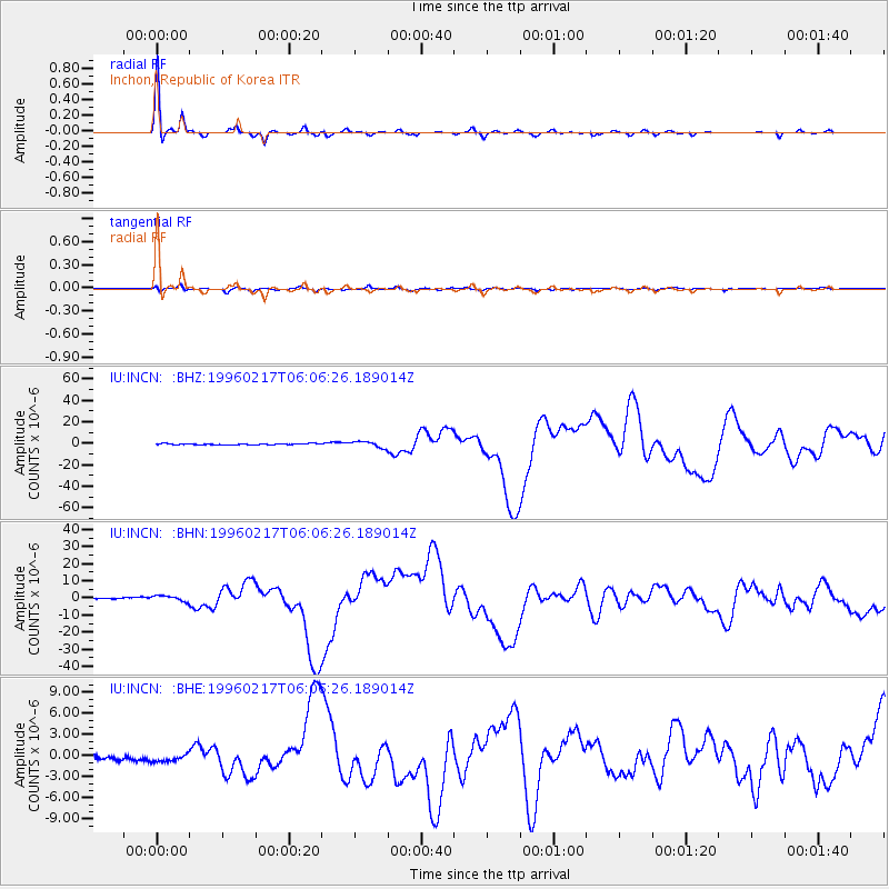
Earthquake location: Irian Jaya Region, Indonesia
Earthquake latitude/longitude: -0.9/137.0
Earthquake time(UTC): 1996/02/17 (048) 05:59:29 GMT
Earthquake Depth: 33 km
Earthquake Magnitude: 6.5 MB, 8.1 MS, 7.9 UNKNOWN
Earthquake Catalog/Contributor: WHDF/NEIC
Network: IU Global Seismograph Network (GSN - IRIS/USGS)
Station: INCN Inchon, Republic of Korea
Lat/Lon: 37.48 N/126.63 E
Elevation: 420 m
Distance: 39.4 deg
Az: 346.942 deg
Baz: 163.501 deg
Ray Param: 0.07492352
Estimated Moho Depth: 30.5 km
Estimated Crust Vp/Vs: 1.80
Assumed Crust Vp: 6.459 km/s
Estimated Crust Vs: 3.584 km/s
Estimated Crust Poisson's Ratio: 0.28
Radial Match: 97.98802 %
Radial Bump: 231
Transverse Match: 80.91954 %
Transverse Bump: 400
SOD ConfigId: 6273
Insert Time: 2010-03-04 15:05:12.452 +0000
GWidth: 2.5
Max Bumps: 400
Tol: 0.001

Signal To Noise

ChannelStoNSTALTA
IU:INCN: :BHN:19960217T06:06:26.189014Z5.0414271.7629249E-63.4968764E-7
IU:INCN: :BHE:19960217T06:06:26.189014Z2.06626845.2773913E-72.5540686E-7
IU:INCN: :BHZ:19960217T06:06:26.189014Z5.5344252.843131E-65.1371745E-7
Arrivals
Ps4.1 SECOND
PpPs12 SECOND
PsPs/PpSs16 SECOND