You are here: Home > Network List > TA - USArray Transportable Network (new EarthScope stations) Stations List
> Station O18K Koktuh Hills, AK, USA > Earthquake Result Viewer
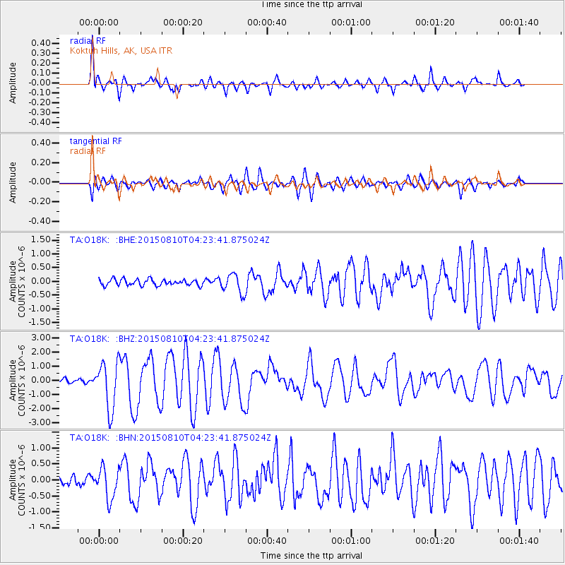
O18K Koktuh Hills, AK, USA - Earthquake Result Viewer
*The percent match for this event was below the threshold and hence no stack was calculated.
| Earthquake location: |
Solomon Islands |
| Earthquake latitude/longitude: |
-9.4/158.0 |
| Earthquake time(UTC): |
2015/08/10 (222) 04:12:14 GMT |
| Earthquake Depth: |
10 km |
| Earthquake Magnitude: |
6.9 MO |
| Earthquake Catalog/Contributor: |
NEIC PDE/NEIC ALERT |
|
| Network: |
TA USArray Transportable Network (new EarthScope stations) |
| Station: |
O18K Koktuh Hills, AK, USA |
| Lat/Lon: |
59.85 N/155.21 W |
| Elevation: |
544 m |
|
| Distance: |
78.4 deg |
| Az: |
22.06 deg |
| Baz: |
227.249 deg |
| Ray Param: |
$rayparam |
*The percent match for this event was below the threshold and hence was not used in the summary stack. |
|
| Radial Match: |
86.587746 % |
| Radial Bump: |
400 |
| Transverse Match: |
81.972305 % |
| Transverse Bump: |
400 |
| SOD ConfigId: |
7422571 |
| Insert Time: |
2019-04-20 06:49:56.632 +0000 |
| GWidth: |
2.5 |
| Max Bumps: |
400 |
| Tol: |
0.001 |
|
Signal To Noise
| Channel | StoN | STA | LTA |
| TA:O18K: :BHZ:20150810T04:23:41.875024Z | 12.096679 | 1.7265779E-6 | 1.4273157E-7 |
| TA:O18K: :BHN:20150810T04:23:41.875024Z | 4.3470244 | 5.0013585E-7 | 1.1505245E-7 |
| TA:O18K: :BHE:20150810T04:23:41.875024Z | 3.5119493 | 3.8663347E-7 | 1.10090845E-7 |
| Arrivals |
| Ps | |
| PpPs | |
| PsPs/PpSs | |


