INCN Inchon, Republic of Korea - Earthquake Result Viewer
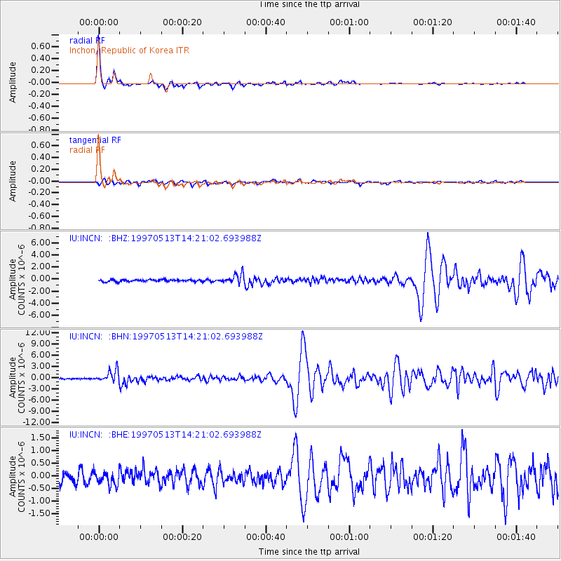
Earthquake location: Hindu Kush Region, Afghanistan
Earthquake latitude/longitude: 36.4/70.9
Earthquake time(UTC): 1997/05/13 (133) 14:13:45 GMT
Earthquake Depth: 196 km
Earthquake Magnitude: 6.1 MB, 6.5 UNKNOWN, 6.4 MW
Earthquake Catalog/Contributor: WHDF/NEIC
Network: IU Global Seismograph Network (GSN - IRIS/USGS)
Station: INCN Inchon, Republic of Korea
Lat/Lon: 37.48 N/126.63 E
Elevation: 420 m
Distance: 44.0 deg
Az: 71.191 deg
Baz: 286.28 deg
Ray Param: 0.07146973
Estimated Moho Depth: 32.5 km
Estimated Crust Vp/Vs: 1.70
Assumed Crust Vp: 6.459 km/s
Estimated Crust Vs: 3.8 km/s
Estimated Crust Poisson's Ratio: 0.24
Radial Match: 97.96012 %
Radial Bump: 231
Transverse Match: 87.23736 %
Transverse Bump: 400
SOD ConfigId: 4480
Insert Time: 2010-03-04 15:08:12.712 +0000
GWidth: 2.5
Max Bumps: 400
Tol: 0.001

Signal To Noise

ChannelStoNSTALTA
IU:INCN: :BHN:19970513T14:21:02.693988Z12.4517381.597851E-61.2832353E-7
IU:INCN: :BHE:19970513T14:21:02.693988Z1.67481542.7594857E-71.6476356E-7
IU:INCN: :BHZ:19970513T14:21:02.693988Z5.00307948.1632464E-71.6316444E-7
Arrivals
Ps3.8 SECOND
PpPs13 SECOND
PsPs/PpSs16 SECOND