You are here: Home > Network List > G - GEOSCOPE Stations List
> Station INU Inuyama, Japan > Earthquake Result Viewer
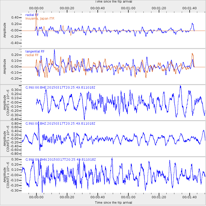
INU Inuyama, Japan - Earthquake Result Viewer
*The percent match for this event was below the threshold and hence no stack was calculated.
| Earthquake location: |
Fiji Islands Region |
| Earthquake latitude/longitude: |
-17.8/-178.6 |
| Earthquake time(UTC): |
2015/03/17 (076) 20:16:19 GMT |
| Earthquake Depth: |
556 km |
| Earthquake Magnitude: |
5.5 MWW, 5.6 MWC, 5.6 MWB |
| Earthquake Catalog/Contributor: |
NEIC PDE/NEIC COMCAT |
|
| Network: |
G GEOSCOPE |
| Station: |
INU Inuyama, Japan |
| Lat/Lon: |
35.35 N/137.03 E |
| Elevation: |
132 m |
|
| Distance: |
67.6 deg |
| Az: |
321.779 deg |
| Baz: |
133.865 deg |
| Ray Param: |
$rayparam |
*The percent match for this event was below the threshold and hence was not used in the summary stack. |
|
| Radial Match: |
65.48701 % |
| Radial Bump: |
400 |
| Transverse Match: |
58.015553 % |
| Transverse Bump: |
400 |
| SOD ConfigId: |
872571 |
| Insert Time: |
2015-04-22 18:55:07.050 +0000 |
| GWidth: |
2.5 |
| Max Bumps: |
400 |
| Tol: |
0.001 |
|
Signal To Noise
| Channel | StoN | STA | LTA |
| G:INU:00:BHZ:20150317T20:25:49.811018Z | 2.4358633 | 3.4686195E-7 | 1.4239797E-7 |
| G:INU:00:BHN:20150317T20:25:49.811018Z | 0.9510137 | 1.5737541E-7 | 1.6548175E-7 |
| G:INU:00:BHE:20150317T20:25:49.811018Z | 1.5945727 | 1.9607837E-7 | 1.2296609E-7 |
| Arrivals |
| Ps | |
| PpPs | |
| PsPs/PpSs | |


