You are here: Home > Network List > TA - USArray Transportable Network (new EarthScope stations) Stations List
> Station A04D Lummi Island, WA, USA > Earthquake Result Viewer
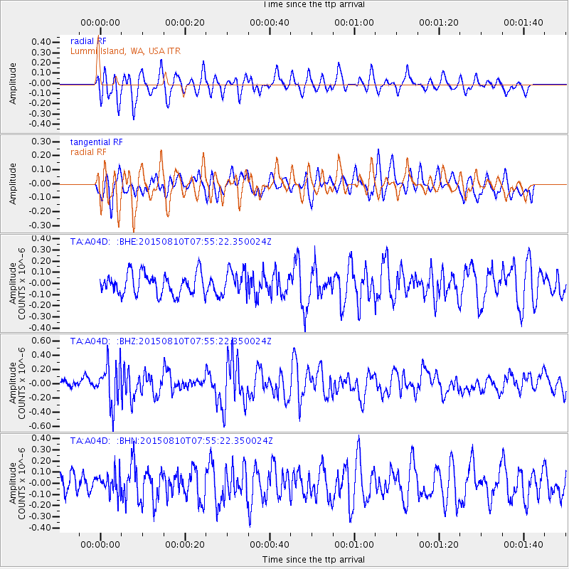
A04D Lummi Island, WA, USA - Earthquake Result Viewer
*The percent match for this event was below the threshold and hence no stack was calculated.
| Earthquake location: |
Tonga Islands |
| Earthquake latitude/longitude: |
-19.6/-174.8 |
| Earthquake time(UTC): |
2015/08/10 (222) 07:43:38 GMT |
| Earthquake Depth: |
57 km |
| Earthquake Magnitude: |
5.6 MB |
| Earthquake Catalog/Contributor: |
NEIC PDE/NEIC ALERT |
|
| Network: |
TA USArray Transportable Network (new EarthScope stations) |
| Station: |
A04D Lummi Island, WA, USA |
| Lat/Lon: |
48.72 N/122.71 W |
| Elevation: |
13 m |
|
| Distance: |
82.3 deg |
| Az: |
31.821 deg |
| Baz: |
228.635 deg |
| Ray Param: |
$rayparam |
*The percent match for this event was below the threshold and hence was not used in the summary stack. |
|
| Radial Match: |
72.13369 % |
| Radial Bump: |
400 |
| Transverse Match: |
54.966007 % |
| Transverse Bump: |
400 |
| SOD ConfigId: |
7422571 |
| Insert Time: |
2019-04-20 07:04:57.631 +0000 |
| GWidth: |
2.5 |
| Max Bumps: |
400 |
| Tol: |
0.001 |
|
Signal To Noise
| Channel | StoN | STA | LTA |
| TA:A04D: :BHZ:20150810T07:55:22.350024Z | 2.8437417 | 2.8699273E-7 | 1.00920815E-7 |
| TA:A04D: :BHN:20150810T07:55:22.350024Z | 0.8007717 | 9.418237E-8 | 1.17614505E-7 |
| TA:A04D: :BHE:20150810T07:55:22.350024Z | 1.1121949 | 1.06776305E-7 | 9.600503E-8 |
| Arrivals |
| Ps | |
| PpPs | |
| PsPs/PpSs | |


