You are here: Home > Network List > TA - USArray Transportable Network (new EarthScope stations) Stations List
> Station L04D Klamath Falls, OR, USA > Earthquake Result Viewer
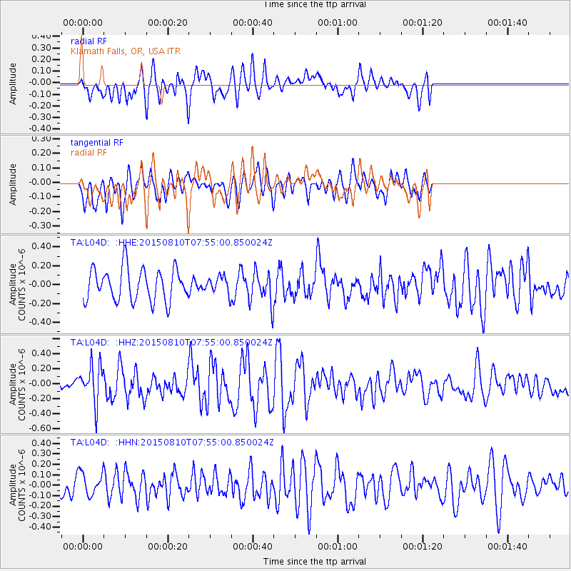
L04D Klamath Falls, OR, USA - Earthquake Result Viewer
*The percent match for this event was below the threshold and hence no stack was calculated.
| Earthquake location: |
Tonga Islands |
| Earthquake latitude/longitude: |
-19.6/-174.8 |
| Earthquake time(UTC): |
2015/08/10 (222) 07:43:38 GMT |
| Earthquake Depth: |
57 km |
| Earthquake Magnitude: |
5.6 MB |
| Earthquake Catalog/Contributor: |
NEIC PDE/NEIC ALERT |
|
| Network: |
TA USArray Transportable Network (new EarthScope stations) |
| Station: |
L04D Klamath Falls, OR, USA |
| Lat/Lon: |
42.22 N/122.30 W |
| Elevation: |
1437 m |
|
| Distance: |
78.3 deg |
| Az: |
37.002 deg |
| Baz: |
229.793 deg |
| Ray Param: |
$rayparam |
*The percent match for this event was below the threshold and hence was not used in the summary stack. |
|
| Radial Match: |
57.80447 % |
| Radial Bump: |
400 |
| Transverse Match: |
60.21594 % |
| Transverse Bump: |
400 |
| SOD ConfigId: |
7422571 |
| Insert Time: |
2019-04-20 07:05:16.882 +0000 |
| GWidth: |
2.5 |
| Max Bumps: |
400 |
| Tol: |
0.001 |
|
Signal To Noise
| Channel | StoN | STA | LTA |
| TA:L04D: :HHZ:20150810T07:55:00.850024Z | 2.3959832 | 2.605782E-7 | 1.0875626E-7 |
| TA:L04D: :HHN:20150810T07:55:00.850024Z | 1.3970553 | 1.1052534E-7 | 7.911308E-8 |
| TA:L04D: :HHE:20150810T07:55:00.850024Z | 0.57931113 | 9.906154E-8 | 1.7099886E-7 |
| Arrivals |
| Ps | |
| PpPs | |
| PsPs/PpSs | |


