You are here: Home > Network List > TA - USArray Transportable Network (new EarthScope stations) Stations List
> Station MSTX Muleshoe, TX, USA > Earthquake Result Viewer
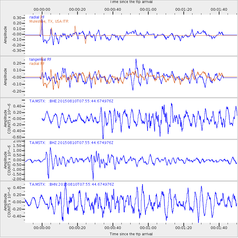
MSTX Muleshoe, TX, USA - Earthquake Result Viewer
*The percent match for this event was below the threshold and hence no stack was calculated.
| Earthquake location: |
Tonga Islands |
| Earthquake latitude/longitude: |
-19.6/-174.8 |
| Earthquake time(UTC): |
2015/08/10 (222) 07:43:38 GMT |
| Earthquake Depth: |
57 km |
| Earthquake Magnitude: |
5.6 MB |
| Earthquake Catalog/Contributor: |
NEIC PDE/NEIC ALERT |
|
| Network: |
TA USArray Transportable Network (new EarthScope stations) |
| Station: |
MSTX Muleshoe, TX, USA |
| Lat/Lon: |
33.97 N/102.77 W |
| Elevation: |
1167 m |
|
| Distance: |
86.8 deg |
| Az: |
52.353 deg |
| Baz: |
243.906 deg |
| Ray Param: |
$rayparam |
*The percent match for this event was below the threshold and hence was not used in the summary stack. |
|
| Radial Match: |
69.04014 % |
| Radial Bump: |
400 |
| Transverse Match: |
62.04207 % |
| Transverse Bump: |
400 |
| SOD ConfigId: |
7422571 |
| Insert Time: |
2019-04-20 07:05:22.176 +0000 |
| GWidth: |
2.5 |
| Max Bumps: |
400 |
| Tol: |
0.001 |
|
Signal To Noise
| Channel | StoN | STA | LTA |
| TA:MSTX: :BHZ:20150810T07:55:44.674976Z | 6.760041 | 7.500678E-7 | 1.10956094E-7 |
| TA:MSTX: :BHN:20150810T07:55:44.674976Z | 0.7525936 | 1.1573864E-7 | 1.5378637E-7 |
| TA:MSTX: :BHE:20150810T07:55:44.674976Z | 2.2250159 | 2.4773473E-7 | 1.1134066E-7 |
| Arrivals |
| Ps | |
| PpPs | |
| PsPs/PpSs | |


