You are here: Home > Network List > TA - USArray Transportable Network (new EarthScope stations) Stations List
> Station O03E Paynes Creek, CA, USA > Earthquake Result Viewer
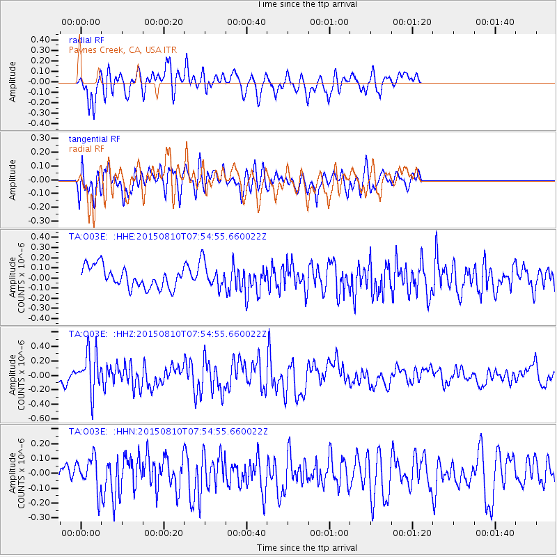
O03E Paynes Creek, CA, USA - Earthquake Result Viewer
*The percent match for this event was below the threshold and hence no stack was calculated.
| Earthquake location: |
Tonga Islands |
| Earthquake latitude/longitude: |
-19.6/-174.8 |
| Earthquake time(UTC): |
2015/08/10 (222) 07:43:38 GMT |
| Earthquake Depth: |
57 km |
| Earthquake Magnitude: |
5.6 MB |
| Earthquake Catalog/Contributor: |
NEIC PDE/NEIC ALERT |
|
| Network: |
TA USArray Transportable Network (new EarthScope stations) |
| Station: |
O03E Paynes Creek, CA, USA |
| Lat/Lon: |
40.29 N/121.80 W |
| Elevation: |
967 m |
|
| Distance: |
77.4 deg |
| Az: |
38.76 deg |
| Baz: |
230.494 deg |
| Ray Param: |
$rayparam |
*The percent match for this event was below the threshold and hence was not used in the summary stack. |
|
| Radial Match: |
64.38007 % |
| Radial Bump: |
400 |
| Transverse Match: |
65.71969 % |
| Transverse Bump: |
400 |
| SOD ConfigId: |
7422571 |
| Insert Time: |
2019-04-20 07:05:24.590 +0000 |
| GWidth: |
2.5 |
| Max Bumps: |
400 |
| Tol: |
0.001 |
|
Signal To Noise
| Channel | StoN | STA | LTA |
| TA:O03E: :HHZ:20150810T07:54:55.660022Z | 2.6632364 | 2.9050128E-7 | 1.0907829E-7 |
| TA:O03E: :HHN:20150810T07:54:55.660022Z | 1.6436877 | 1.14202415E-7 | 6.9479384E-8 |
| TA:O03E: :HHE:20150810T07:54:55.660022Z | 1.1093264 | 1.14286735E-7 | 1.03023545E-7 |
| Arrivals |
| Ps | |
| PpPs | |
| PsPs/PpSs | |


