You are here: Home > Network List > UW - Pacific Northwest Regional Seismic Network Stations List
> Station UMAT Pilot Rock, OR, USA > Earthquake Result Viewer
UMAT Pilot Rock, OR, USA - Earthquake Result Viewer
*The percent match for this event was below the threshold and hence no stack was calculated.
| Earthquake location: |
Tonga Islands |
| Earthquake latitude/longitude: |
-19.6/-174.8 |
| Earthquake time(UTC): |
2015/08/10 (222) 07:43:38 GMT |
| Earthquake Depth: |
57 km |
| Earthquake Magnitude: |
5.6 MB |
| Earthquake Catalog/Contributor: |
NEIC PDE/NEIC ALERT |
|
| Network: |
UW Pacific Northwest Regional Seismic Network |
| Station: |
UMAT Pilot Rock, OR, USA |
| Lat/Lon: |
45.29 N/118.96 W |
| Elevation: |
1318 m |
|
| Distance: |
82.1 deg |
| Az: |
36.138 deg |
| Baz: |
231.952 deg |
| Ray Param: |
$rayparam |
*The percent match for this event was below the threshold and hence was not used in the summary stack. |
|
| Radial Match: |
59.846268 % |
| Radial Bump: |
400 |
| Transverse Match: |
67.91645 % |
| Transverse Bump: |
400 |
| SOD ConfigId: |
7422571 |
| Insert Time: |
2019-04-20 07:06:32.481 +0000 |
| GWidth: |
2.5 |
| Max Bumps: |
400 |
| Tol: |
0.001 |
|
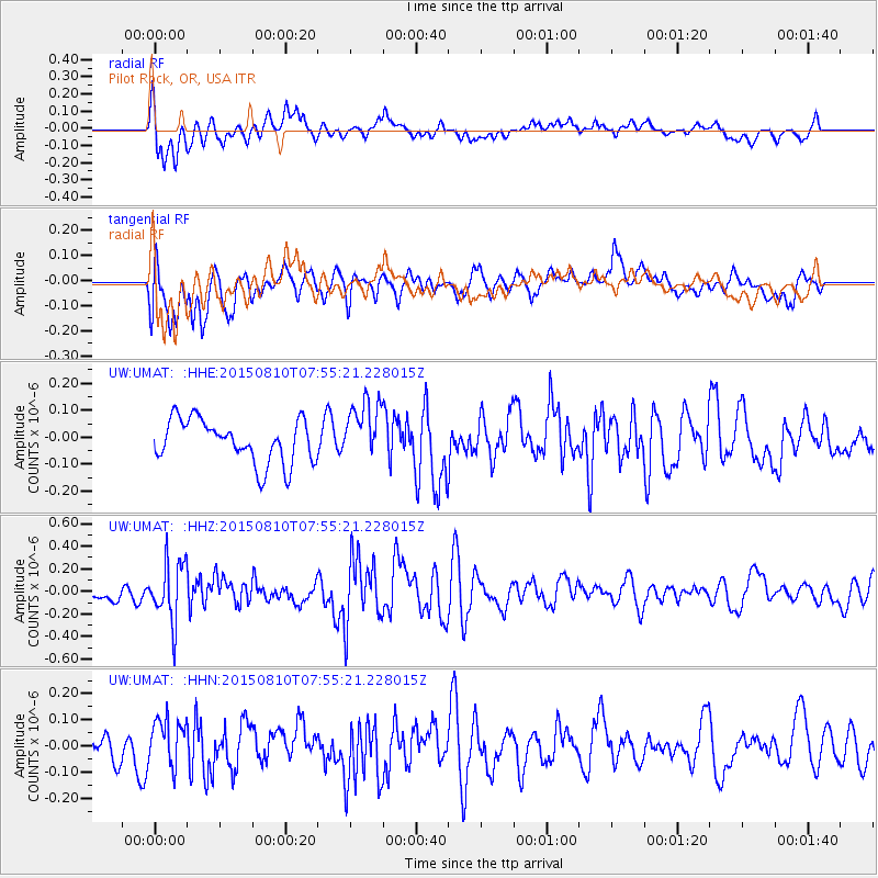
Signal To Noise
| Channel | StoN | STA | LTA |
| UW:UMAT: :HHZ:20150810T07:55:21.228015Z | 4.1235094 | 2.6208502E-7 | 6.355873E-8 |
| UW:UMAT: :HHN:20150810T07:55:21.228015Z | 1.5233011 | 8.910127E-8 | 5.849222E-8 |
| UW:UMAT: :HHE:20150810T07:55:21.228015Z | 1.4429059 | 1.1653429E-7 | 8.0763606E-8 |
| Arrivals |
| Ps | |
| PpPs | |
| PsPs/PpSs | |


