You are here: Home > Network List > UW - Pacific Northwest Regional Seismic Network Stations List
> Station YACT Amboy, WA, USA > Earthquake Result Viewer
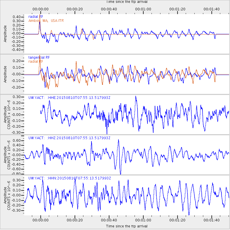
YACT Amboy, WA, USA - Earthquake Result Viewer
*The percent match for this event was below the threshold and hence no stack was calculated.
| Earthquake location: |
Tonga Islands |
| Earthquake latitude/longitude: |
-19.6/-174.8 |
| Earthquake time(UTC): |
2015/08/10 (222) 07:43:38 GMT |
| Earthquake Depth: |
57 km |
| Earthquake Magnitude: |
5.6 MB |
| Earthquake Catalog/Contributor: |
NEIC PDE/NEIC ALERT |
|
| Network: |
UW Pacific Northwest Regional Seismic Network |
| Station: |
YACT Amboy, WA, USA |
| Lat/Lon: |
45.93 N/122.42 W |
| Elevation: |
211 m |
|
| Distance: |
80.7 deg |
| Az: |
34.076 deg |
| Baz: |
229.179 deg |
| Ray Param: |
$rayparam |
*The percent match for this event was below the threshold and hence was not used in the summary stack. |
|
| Radial Match: |
70.083206 % |
| Radial Bump: |
400 |
| Transverse Match: |
53.695435 % |
| Transverse Bump: |
400 |
| SOD ConfigId: |
7422571 |
| Insert Time: |
2019-04-20 07:06:33.543 +0000 |
| GWidth: |
2.5 |
| Max Bumps: |
400 |
| Tol: |
0.001 |
|
Signal To Noise
| Channel | StoN | STA | LTA |
| UW:YACT: :HHZ:20150810T07:55:13.517993Z | 2.133957 | 2.3538618E-7 | 1.1030503E-7 |
| UW:YACT: :HHN:20150810T07:55:13.517993Z | 2.049472 | 1.6895957E-7 | 8.244053E-8 |
| UW:YACT: :HHE:20150810T07:55:13.517993Z | 0.8782375 | 7.46399E-8 | 8.498829E-8 |
| Arrivals |
| Ps | |
| PpPs | |
| PsPs/PpSs | |


