You are here: Home > Network List > US - United States National Seismic Network Stations List
> Station MNTX Cornudas Mountains, Texas, USA > Earthquake Result Viewer
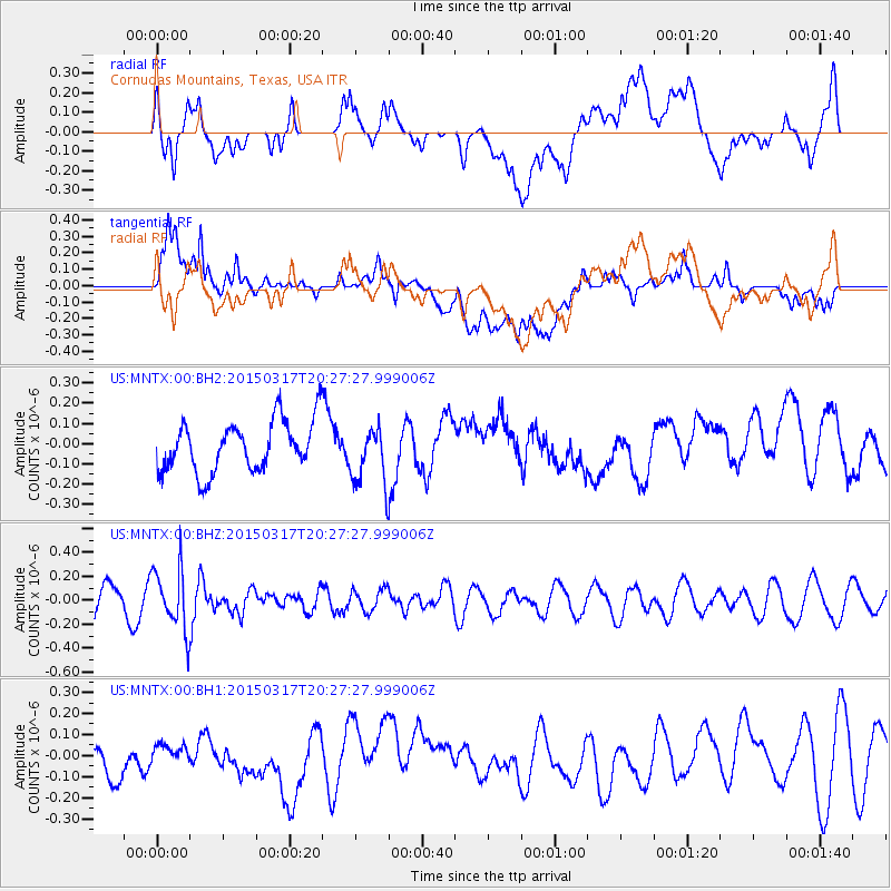
MNTX Cornudas Mountains, Texas, USA - Earthquake Result Viewer
*The percent match for this event was below the threshold and hence no stack was calculated.
| Earthquake location: |
Fiji Islands Region |
| Earthquake latitude/longitude: |
-17.8/-178.6 |
| Earthquake time(UTC): |
2015/03/17 (076) 20:16:19 GMT |
| Earthquake Depth: |
556 km |
| Earthquake Magnitude: |
5.5 MWW, 5.6 MWC, 5.6 MWB |
| Earthquake Catalog/Contributor: |
NEIC PDE/NEIC COMCAT |
|
| Network: |
US United States National Seismic Network |
| Station: |
MNTX Cornudas Mountains, Texas, USA |
| Lat/Lon: |
31.70 N/105.38 W |
| Elevation: |
404 m |
|
| Distance: |
85.7 deg |
| Az: |
54.915 deg |
| Baz: |
246.134 deg |
| Ray Param: |
$rayparam |
*The percent match for this event was below the threshold and hence was not used in the summary stack. |
|
| Radial Match: |
50.839325 % |
| Radial Bump: |
400 |
| Transverse Match: |
50.378014 % |
| Transverse Bump: |
400 |
| SOD ConfigId: |
872571 |
| Insert Time: |
2015-04-22 19:00:48.033 +0000 |
| GWidth: |
2.5 |
| Max Bumps: |
400 |
| Tol: |
0.001 |
|
Signal To Noise
| Channel | StoN | STA | LTA |
| US:MNTX:00:BHZ:20150317T20:27:27.999006Z | 1.9525647 | 2.5711262E-7 | 1.3167944E-7 |
| US:MNTX:00:BH1:20150317T20:27:27.999006Z | 0.31752837 | 4.1247468E-8 | 1.2990168E-7 |
| US:MNTX:00:BH2:20150317T20:27:27.999006Z | 1.1585319 | 1.4429187E-7 | 1.2454717E-7 |
| Arrivals |
| Ps | |
| PpPs | |
| PsPs/PpSs | |


