You are here: Home > Network List > US - United States National Seismic Network Stations List
> Station DGMT Dagmar, Montana, USA > Earthquake Result Viewer
DGMT Dagmar, Montana, USA - Earthquake Result Viewer
*The percent match for this event was below the threshold and hence no stack was calculated.
| Earthquake location: |
Afghanistan-Tajikistan Bord Reg. |
| Earthquake latitude/longitude: |
36.5/71.2 |
| Earthquake time(UTC): |
2015/08/10 (222) 10:05:25 GMT |
| Earthquake Depth: |
223 km |
| Earthquake Magnitude: |
5.7 MB |
| Earthquake Catalog/Contributor: |
NEIC PDE/NEIC COMCAT |
|
| Network: |
US United States National Seismic Network |
| Station: |
DGMT Dagmar, Montana, USA |
| Lat/Lon: |
48.47 N/104.20 W |
| Elevation: |
0.0 m |
|
| Distance: |
95.3 deg |
| Az: |
356.926 deg |
| Baz: |
3.721 deg |
| Ray Param: |
$rayparam |
*The percent match for this event was below the threshold and hence was not used in the summary stack. |
|
| Radial Match: |
59.570236 % |
| Radial Bump: |
400 |
| Transverse Match: |
45.690624 % |
| Transverse Bump: |
380 |
| SOD ConfigId: |
7422571 |
| Insert Time: |
2019-04-20 07:18:10.816 +0000 |
| GWidth: |
2.5 |
| Max Bumps: |
400 |
| Tol: |
0.001 |
|
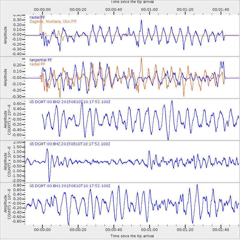
Signal To Noise
| Channel | StoN | STA | LTA |
| US:DGMT:00:BHZ:20150810T10:17:52.100Z | 5.465289 | 8.847767E-7 | 1.618902E-7 |
| US:DGMT:00:BH1:20150810T10:17:52.100Z | 1.0045843 | 2.0095209E-7 | 2.0003507E-7 |
| US:DGMT:00:BH2:20150810T10:17:52.100Z | 0.7447616 | 2.1532064E-7 | 2.891135E-7 |
| Arrivals |
| Ps | |
| PpPs | |
| PsPs/PpSs | |


