You are here: Home > Network List > TA - USArray Transportable Network (new EarthScope stations) Stations List
> Station A04D Lummi Island, WA, USA > Earthquake Result Viewer
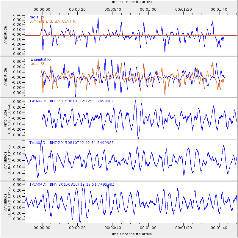
A04D Lummi Island, WA, USA - Earthquake Result Viewer
*The percent match for this event was below the threshold and hence no stack was calculated.
| Earthquake location: |
New Britain Region, P.N.G. |
| Earthquake latitude/longitude: |
-4.9/152.5 |
| Earthquake time(UTC): |
2015/08/10 (222) 12:00:28 GMT |
| Earthquake Depth: |
55 km |
| Earthquake Magnitude: |
4.9 mb |
| Earthquake Catalog/Contributor: |
ISC/ISC |
|
| Network: |
TA USArray Transportable Network (new EarthScope stations) |
| Station: |
A04D Lummi Island, WA, USA |
| Lat/Lon: |
48.72 N/122.71 W |
| Elevation: |
13 m |
|
| Distance: |
90.3 deg |
| Az: |
41.266 deg |
| Baz: |
262.884 deg |
| Ray Param: |
$rayparam |
*The percent match for this event was below the threshold and hence was not used in the summary stack. |
|
| Radial Match: |
45.045815 % |
| Radial Bump: |
400 |
| Transverse Match: |
52.545734 % |
| Transverse Bump: |
350 |
| SOD ConfigId: |
7422571 |
| Insert Time: |
2019-04-20 07:25:12.241 +0000 |
| GWidth: |
2.5 |
| Max Bumps: |
400 |
| Tol: |
0.001 |
|
Signal To Noise
| Channel | StoN | STA | LTA |
| TA:A04D: :BHZ:20150810T12:12:51.749998Z | 1.889563 | 1.6208273E-7 | 8.577789E-8 |
| TA:A04D: :BHN:20150810T12:12:51.749998Z | 1.4600865 | 1.1963041E-7 | 8.1933784E-8 |
| TA:A04D: :BHE:20150810T12:12:51.749998Z | 0.9192846 | 8.0556006E-8 | 8.762902E-8 |
| Arrivals |
| Ps | |
| PpPs | |
| PsPs/PpSs | |


