You are here: Home > Network List > US - United States National Seismic Network Stations List
> Station EGMT Eagleton, Montana, USA > Earthquake Result Viewer
EGMT Eagleton, Montana, USA - Earthquake Result Viewer
*The percent match for this event was below the threshold and hence no stack was calculated.
| Earthquake location: |
Kuril Islands |
| Earthquake latitude/longitude: |
43.7/147.6 |
| Earthquake time(UTC): |
2015/08/10 (222) 14:59:27 GMT |
| Earthquake Depth: |
45 km |
| Earthquake Magnitude: |
4.7 mb |
| Earthquake Catalog/Contributor: |
ISC/ISC |
|
| Network: |
US United States National Seismic Network |
| Station: |
EGMT Eagleton, Montana, USA |
| Lat/Lon: |
48.02 N/109.75 W |
| Elevation: |
1055 m |
|
| Distance: |
66.2 deg |
| Az: |
45.699 deg |
| Baz: |
309.337 deg |
| Ray Param: |
$rayparam |
*The percent match for this event was below the threshold and hence was not used in the summary stack. |
|
| Radial Match: |
57.21824 % |
| Radial Bump: |
400 |
| Transverse Match: |
40.340843 % |
| Transverse Bump: |
400 |
| SOD ConfigId: |
7422571 |
| Insert Time: |
2019-04-20 07:34:29.857 +0000 |
| GWidth: |
2.5 |
| Max Bumps: |
400 |
| Tol: |
0.001 |
|
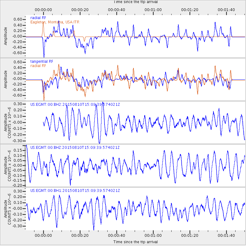
Signal To Noise
| Channel | StoN | STA | LTA |
| US:EGMT:00:BHZ:20150810T15:09:39.574021Z | 0.79770017 | 6.183317E-8 | 7.75143E-8 |
| US:EGMT:00:BH1:20150810T15:09:39.574021Z | 1.0054443 | 1.0508327E-7 | 1.0451426E-7 |
| US:EGMT:00:BH2:20150810T15:09:39.574021Z | 1.8006059 | 2.1989864E-7 | 1.221248E-7 |
| Arrivals |
| Ps | |
| PpPs | |
| PsPs/PpSs | |


