You are here: Home > Network List > US - United States National Seismic Network Stations List
> Station HAWA Hanford, Washington, USA > Earthquake Result Viewer
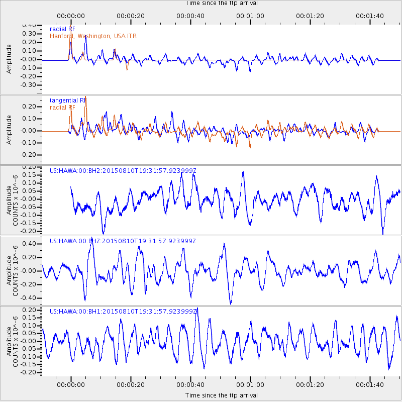
HAWA Hanford, Washington, USA - Earthquake Result Viewer
*The percent match for this event was below the threshold and hence no stack was calculated.
| Earthquake location: |
Kermadec Islands Region |
| Earthquake latitude/longitude: |
-27.3/-176.2 |
| Earthquake time(UTC): |
2015/08/10 (222) 19:19:33 GMT |
| Earthquake Depth: |
20 km |
| Earthquake Magnitude: |
5.5 MW |
| Earthquake Catalog/Contributor: |
ISC/ISC |
|
| Network: |
US United States National Seismic Network |
| Station: |
HAWA Hanford, Washington, USA |
| Lat/Lon: |
46.39 N/119.53 W |
| Elevation: |
364 m |
|
| Distance: |
89.5 deg |
| Az: |
35.342 deg |
| Baz: |
228.038 deg |
| Ray Param: |
$rayparam |
*The percent match for this event was below the threshold and hence was not used in the summary stack. |
|
| Radial Match: |
74.76427 % |
| Radial Bump: |
340 |
| Transverse Match: |
52.14876 % |
| Transverse Bump: |
400 |
| SOD ConfigId: |
7422571 |
| Insert Time: |
2019-04-20 07:41:47.121 +0000 |
| GWidth: |
2.5 |
| Max Bumps: |
400 |
| Tol: |
0.001 |
|
Signal To Noise
| Channel | StoN | STA | LTA |
| US:HAWA:00:BHZ:20150810T19:31:57.923999Z | 2.731266 | 1.4175103E-7 | 5.1899384E-8 |
| US:HAWA:00:BH1:20150810T19:31:57.923999Z | 1.653209 | 7.521988E-8 | 4.5499316E-8 |
| US:HAWA:00:BH2:20150810T19:31:57.923999Z | 1.685699 | 9.050205E-8 | 5.3688147E-8 |
| Arrivals |
| Ps | |
| PpPs | |
| PsPs/PpSs | |


