You are here: Home > Network List > TA - USArray Transportable Network (new EarthScope stations) Stations List
> Station R11A Troy Canyon, Currant, NV, USA > Earthquake Result Viewer
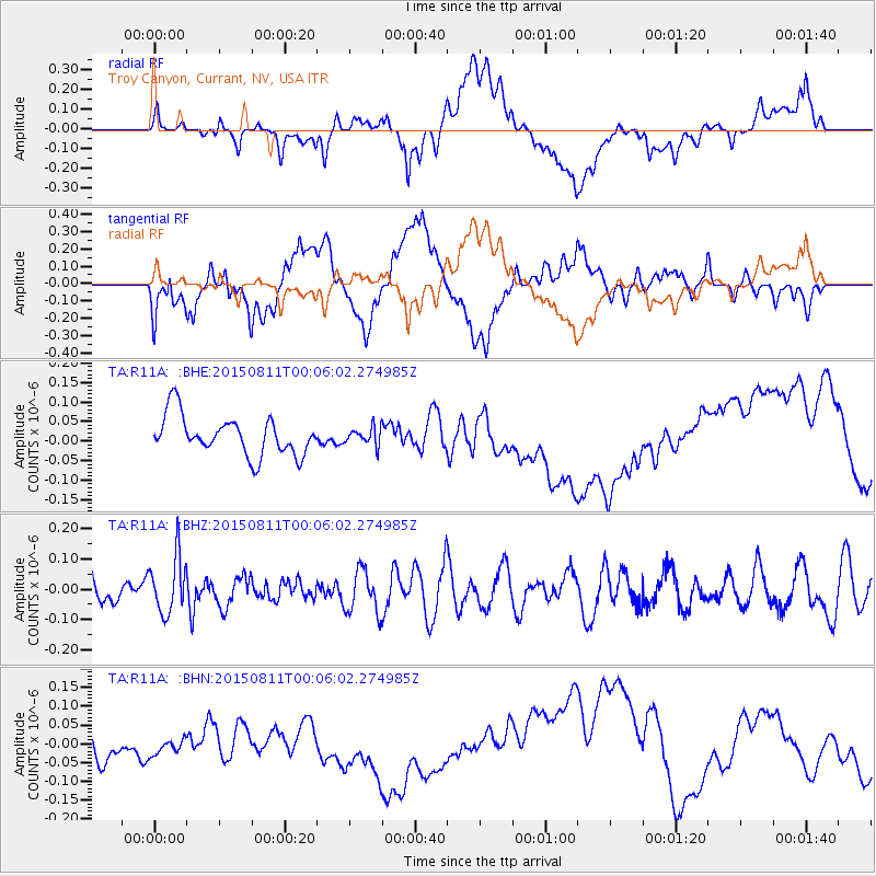
R11A Troy Canyon, Currant, NV, USA - Earthquake Result Viewer
*The percent match for this event was below the threshold and hence no stack was calculated.
| Earthquake location: |
New Britain Region, P.N.G. |
| Earthquake latitude/longitude: |
-5.6/151.9 |
| Earthquake time(UTC): |
2015/08/10 (222) 23:53:14 GMT |
| Earthquake Depth: |
45 km |
| Earthquake Magnitude: |
5.3 MW |
| Earthquake Catalog/Contributor: |
ISC/ISC |
|
| Network: |
TA USArray Transportable Network (new EarthScope stations) |
| Station: |
R11A Troy Canyon, Currant, NV, USA |
| Lat/Lon: |
38.35 N/115.59 W |
| Elevation: |
1756 m |
|
| Distance: |
95.4 deg |
| Az: |
52.092 deg |
| Baz: |
267.203 deg |
| Ray Param: |
$rayparam |
*The percent match for this event was below the threshold and hence was not used in the summary stack. |
|
| Radial Match: |
18.597065 % |
| Radial Bump: |
400 |
| Transverse Match: |
25.93249 % |
| Transverse Bump: |
400 |
| SOD ConfigId: |
7422571 |
| Insert Time: |
2019-04-20 07:47:57.699 +0000 |
| GWidth: |
2.5 |
| Max Bumps: |
400 |
| Tol: |
0.001 |
|
Signal To Noise
| Channel | StoN | STA | LTA |
| TA:R11A: :BHZ:20150811T00:06:02.274985Z | 1.5526718 | 9.2484406E-8 | 5.9564684E-8 |
| TA:R11A: :BHN:20150811T00:06:02.274985Z | 0.89392257 | 5.2040093E-8 | 5.8215434E-8 |
| TA:R11A: :BHE:20150811T00:06:02.274985Z | 0.43273994 | 2.1700531E-8 | 5.014682E-8 |
| Arrivals |
| Ps | |
| PpPs | |
| PsPs/PpSs | |


