You are here: Home > Network List > US - United States National Seismic Network Stations List
> Station MSO Missoula, Montana, USA > Earthquake Result Viewer
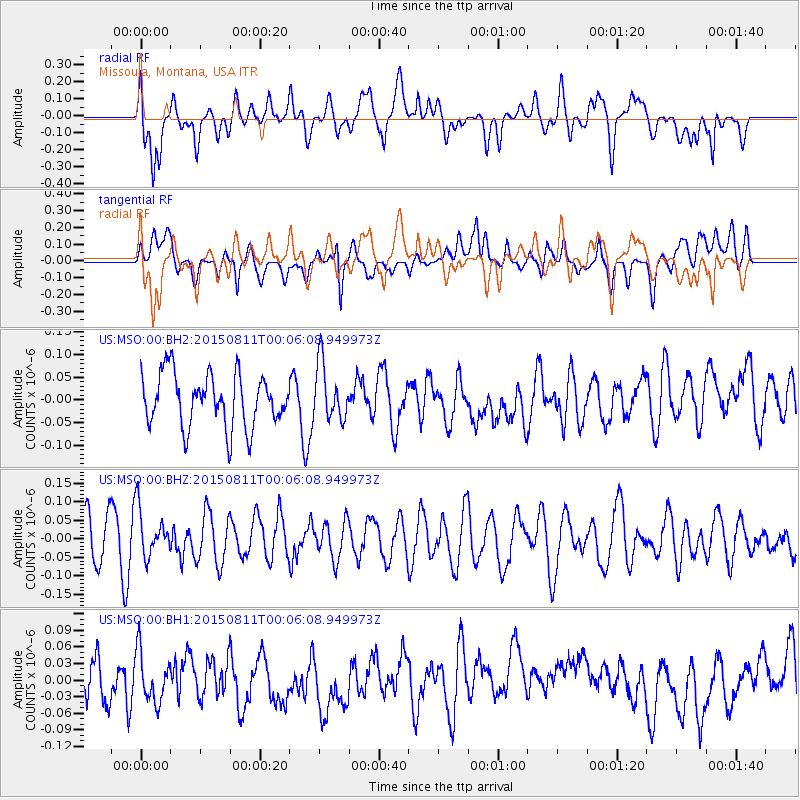
MSO Missoula, Montana, USA - Earthquake Result Viewer
*The percent match for this event was below the threshold and hence no stack was calculated.
| Earthquake location: |
New Britain Region, P.N.G. |
| Earthquake latitude/longitude: |
-5.6/151.9 |
| Earthquake time(UTC): |
2015/08/10 (222) 23:53:14 GMT |
| Earthquake Depth: |
45 km |
| Earthquake Magnitude: |
5.3 MW |
| Earthquake Catalog/Contributor: |
ISC/ISC |
|
| Network: |
US United States National Seismic Network |
| Station: |
MSO Missoula, Montana, USA |
| Lat/Lon: |
46.83 N/113.94 W |
| Elevation: |
1264 m |
|
| Distance: |
96.9 deg |
| Az: |
43.611 deg |
| Baz: |
269.223 deg |
| Ray Param: |
$rayparam |
*The percent match for this event was below the threshold and hence was not used in the summary stack. |
|
| Radial Match: |
54.197163 % |
| Radial Bump: |
400 |
| Transverse Match: |
56.51945 % |
| Transverse Bump: |
400 |
| SOD ConfigId: |
7422571 |
| Insert Time: |
2019-04-20 07:48:24.670 +0000 |
| GWidth: |
2.5 |
| Max Bumps: |
400 |
| Tol: |
0.001 |
|
Signal To Noise
| Channel | StoN | STA | LTA |
| US:MSO:00:BHZ:20150811T00:06:08.949973Z | 1.1165943 | 6.366721E-8 | 5.70191E-8 |
| US:MSO:00:BH1:20150811T00:06:08.949973Z | 0.93705285 | 4.4883134E-8 | 4.7898187E-8 |
| US:MSO:00:BH2:20150811T00:06:08.949973Z | 1.0750769 | 6.2364435E-8 | 5.8009277E-8 |
| Arrivals |
| Ps | |
| PpPs | |
| PsPs/PpSs | |


