You are here: Home > Network List > UW - Pacific Northwest Regional Seismic Network Stations List
> Station LEBA Lebam, WA, USA > Earthquake Result Viewer
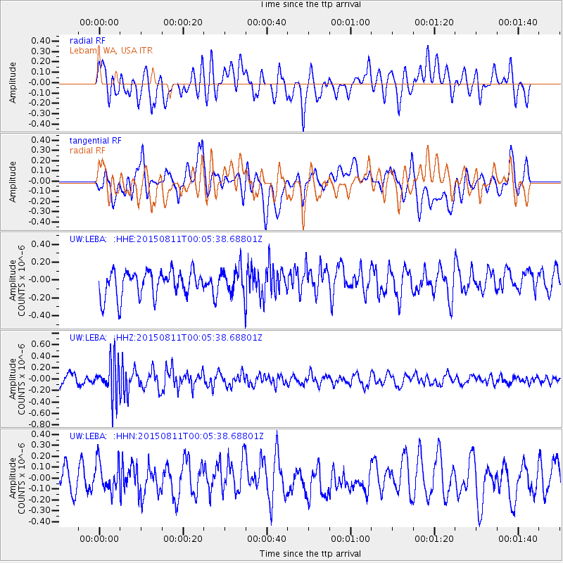
LEBA Lebam, WA, USA - Earthquake Result Viewer
*The percent match for this event was below the threshold and hence no stack was calculated.
| Earthquake location: |
New Britain Region, P.N.G. |
| Earthquake latitude/longitude: |
-5.6/151.9 |
| Earthquake time(UTC): |
2015/08/10 (222) 23:53:14 GMT |
| Earthquake Depth: |
45 km |
| Earthquake Magnitude: |
5.3 MW |
| Earthquake Catalog/Contributor: |
ISC/ISC |
|
| Network: |
UW Pacific Northwest Regional Seismic Network |
| Station: |
LEBA Lebam, WA, USA |
| Lat/Lon: |
46.55 N/123.56 W |
| Elevation: |
73 m |
|
| Distance: |
90.3 deg |
| Az: |
43.4 deg |
| Baz: |
262.249 deg |
| Ray Param: |
$rayparam |
*The percent match for this event was below the threshold and hence was not used in the summary stack. |
|
| Radial Match: |
57.81993 % |
| Radial Bump: |
400 |
| Transverse Match: |
65.540054 % |
| Transverse Bump: |
400 |
| SOD ConfigId: |
7422571 |
| Insert Time: |
2019-04-20 07:48:34.714 +0000 |
| GWidth: |
2.5 |
| Max Bumps: |
400 |
| Tol: |
0.001 |
|
Signal To Noise
| Channel | StoN | STA | LTA |
| UW:LEBA: :HHZ:20150811T00:05:38.68801Z | 3.7343078 | 3.0772276E-7 | 8.2404235E-8 |
| UW:LEBA: :HHN:20150811T00:05:38.68801Z | 1.3396165 | 1.4601953E-7 | 1.0900099E-7 |
| UW:LEBA: :HHE:20150811T00:05:38.68801Z | 1.0280902 | 1.4891756E-7 | 1.4484873E-7 |
| Arrivals |
| Ps | |
| PpPs | |
| PsPs/PpSs | |


