You are here: Home > Network List > US - United States National Seismic Network Stations List
> Station AMTX Amarillo, Texas, USA > Earthquake Result Viewer
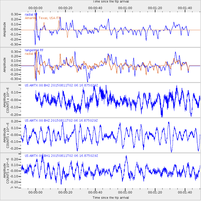
AMTX Amarillo, Texas, USA - Earthquake Result Viewer
*The percent match for this event was below the threshold and hence no stack was calculated.
| Earthquake location: |
Kermadec Islands Region |
| Earthquake latitude/longitude: |
-31.6/-177.9 |
| Earthquake time(UTC): |
2015/08/11 (223) 01:53:18 GMT |
| Earthquake Depth: |
35 km |
| Earthquake Magnitude: |
4.8 mb |
| Earthquake Catalog/Contributor: |
ISC/ISC |
|
| Network: |
US United States National Seismic Network |
| Station: |
AMTX Amarillo, Texas, USA |
| Lat/Lon: |
34.53 N/101.41 W |
| Elevation: |
1010 m |
|
| Distance: |
97.5 deg |
| Az: |
54.06 deg |
| Baz: |
236.81 deg |
| Ray Param: |
$rayparam |
*The percent match for this event was below the threshold and hence was not used in the summary stack. |
|
| Radial Match: |
42.7458 % |
| Radial Bump: |
400 |
| Transverse Match: |
42.03606 % |
| Transverse Bump: |
400 |
| SOD ConfigId: |
7422571 |
| Insert Time: |
2019-04-20 07:54:23.059 +0000 |
| GWidth: |
2.5 |
| Max Bumps: |
400 |
| Tol: |
0.001 |
|
Signal To Noise
| Channel | StoN | STA | LTA |
| US:AMTX:00:BHZ:20150811T02:06:16.875029Z | 1.0284436 | 6.926831E-8 | 6.735256E-8 |
| US:AMTX:00:BH1:20150811T02:06:16.875029Z | 2.180249 | 1.5910035E-7 | 7.297348E-8 |
| US:AMTX:00:BH2:20150811T02:06:16.875029Z | 1.6904033 | 9.1438096E-8 | 5.409247E-8 |
| Arrivals |
| Ps | |
| PpPs | |
| PsPs/PpSs | |


