You are here: Home > Network List > UW - Pacific Northwest Regional Seismic Network Stations List
> Station HOOD Mt Hood Meadows, OR CREST BB SMO > Earthquake Result Viewer
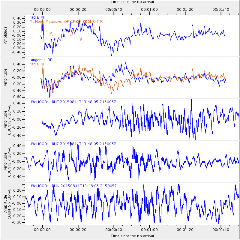
HOOD Mt Hood Meadows, OR CREST BB SMO - Earthquake Result Viewer
*The percent match for this event was below the threshold and hence no stack was calculated.
| Earthquake location: |
Kermadec Islands Region |
| Earthquake latitude/longitude: |
-27.2/-176.1 |
| Earthquake time(UTC): |
2015/08/11 (223) 13:35:51 GMT |
| Earthquake Depth: |
28 km |
| Earthquake Magnitude: |
5.5 MW |
| Earthquake Catalog/Contributor: |
ISC/ISC |
|
| Network: |
UW Pacific Northwest Regional Seismic Network |
| Station: |
HOOD Mt Hood Meadows, OR CREST BB SMO |
| Lat/Lon: |
45.32 N/121.65 W |
| Elevation: |
1520 m |
|
| Distance: |
87.5 deg |
| Az: |
35.072 deg |
| Baz: |
226.508 deg |
| Ray Param: |
$rayparam |
*The percent match for this event was below the threshold and hence was not used in the summary stack. |
|
| Radial Match: |
61.25595 % |
| Radial Bump: |
400 |
| Transverse Match: |
60.55083 % |
| Transverse Bump: |
400 |
| SOD ConfigId: |
7422571 |
| Insert Time: |
2019-04-20 08:01:48.387 +0000 |
| GWidth: |
2.5 |
| Max Bumps: |
400 |
| Tol: |
0.001 |
|
Signal To Noise
| Channel | StoN | STA | LTA |
| UW:HOOD: :BHZ:20150811T13:48:05.215005Z | 2.7148616 | 2.2698927E-7 | 8.360988E-8 |
| UW:HOOD: :BHN:20150811T13:48:05.215005Z | 2.5680997 | 1.5375275E-7 | 5.987024E-8 |
| UW:HOOD: :BHE:20150811T13:48:05.215005Z | 1.1167145 | 1.5111267E-7 | 1.35319E-7 |
| Arrivals |
| Ps | |
| PpPs | |
| PsPs/PpSs | |


