You are here: Home > Network List > CN - Canadian National Seismograph Network Stations List
> Station INK INUVIK, NT > Earthquake Result Viewer
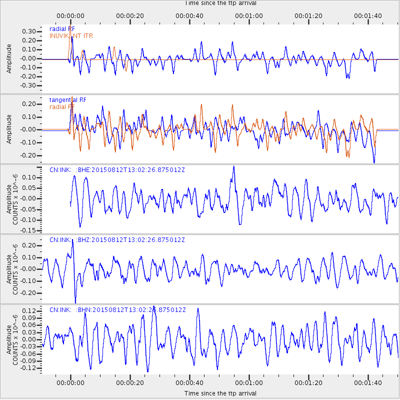
INK INUVIK, NT - Earthquake Result Viewer
*The percent match for this event was below the threshold and hence no stack was calculated.
| Earthquake location: |
Fiji Islands Region |
| Earthquake latitude/longitude: |
-16.5/-177.3 |
| Earthquake time(UTC): |
2015/08/12 (224) 12:50:43 GMT |
| Earthquake Depth: |
415 km |
| Earthquake Magnitude: |
5.3 MW |
| Earthquake Catalog/Contributor: |
ISC/ISC |
|
| Network: |
CN Canadian National Seismograph Network |
| Station: |
INK INUVIK, NT |
| Lat/Lon: |
68.31 N/133.53 W |
| Elevation: |
44 m |
|
| Distance: |
90.2 deg |
| Az: |
14.892 deg |
| Baz: |
221.544 deg |
| Ray Param: |
$rayparam |
*The percent match for this event was below the threshold and hence was not used in the summary stack. |
|
| Radial Match: |
64.53903 % |
| Radial Bump: |
400 |
| Transverse Match: |
58.31055 % |
| Transverse Bump: |
400 |
| SOD ConfigId: |
7422571 |
| Insert Time: |
2019-04-20 08:19:01.434 +0000 |
| GWidth: |
2.5 |
| Max Bumps: |
400 |
| Tol: |
0.001 |
|
Signal To Noise
| Channel | StoN | STA | LTA |
| CN:INK: :BHZ:20150812T13:02:26.875012Z | 2.1983302 | 1.3458035E-7 | 6.121935E-8 |
| CN:INK: :BHN:20150812T13:02:26.875012Z | 1.4114648 | 4.9947836E-8 | 3.5387234E-8 |
| CN:INK: :BHE:20150812T13:02:26.875012Z | 0.58950186 | 3.2631345E-8 | 5.5354093E-8 |
| Arrivals |
| Ps | |
| PpPs | |
| PsPs/PpSs | |


