You are here: Home > Network List > TA - USArray Transportable Network (new EarthScope stations) Stations List
> Station J20K Nowitna River, AK, USA > Earthquake Result Viewer
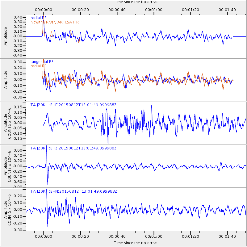
J20K Nowitna River, AK, USA - Earthquake Result Viewer
*The percent match for this event was below the threshold and hence no stack was calculated.
| Earthquake location: |
Fiji Islands Region |
| Earthquake latitude/longitude: |
-16.5/-177.3 |
| Earthquake time(UTC): |
2015/08/12 (224) 12:50:43 GMT |
| Earthquake Depth: |
415 km |
| Earthquake Magnitude: |
5.3 MW |
| Earthquake Catalog/Contributor: |
ISC/ISC |
|
| Network: |
TA USArray Transportable Network (new EarthScope stations) |
| Station: |
J20K Nowitna River, AK, USA |
| Lat/Lon: |
64.18 N/154.15 W |
| Elevation: |
314 m |
|
| Distance: |
82.4 deg |
| Az: |
9.987 deg |
| Baz: |
202.328 deg |
| Ray Param: |
$rayparam |
*The percent match for this event was below the threshold and hence was not used in the summary stack. |
|
| Radial Match: |
72.36801 % |
| Radial Bump: |
400 |
| Transverse Match: |
64.78005 % |
| Transverse Bump: |
400 |
| SOD ConfigId: |
7422571 |
| Insert Time: |
2019-04-20 08:22:11.196 +0000 |
| GWidth: |
2.5 |
| Max Bumps: |
400 |
| Tol: |
0.001 |
|
Signal To Noise
| Channel | StoN | STA | LTA |
| TA:J20K: :BHZ:20150812T13:01:49.099988Z | 5.305709 | 2.6562273E-7 | 5.0063573E-8 |
| TA:J20K: :BHN:20150812T13:01:49.099988Z | 3.0323074 | 1.0264926E-7 | 3.3851865E-8 |
| TA:J20K: :BHE:20150812T13:01:49.099988Z | 1.9668921 | 6.81852E-8 | 3.4666467E-8 |
| Arrivals |
| Ps | |
| PpPs | |
| PsPs/PpSs | |


