You are here: Home > Network List > TA - USArray Transportable Network (new EarthScope stations) Stations List
> Station O18K Koktuh Hills, AK, USA > Earthquake Result Viewer
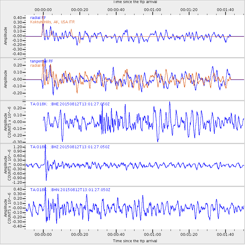
O18K Koktuh Hills, AK, USA - Earthquake Result Viewer
*The percent match for this event was below the threshold and hence no stack was calculated.
| Earthquake location: |
Fiji Islands Region |
| Earthquake latitude/longitude: |
-16.5/-177.3 |
| Earthquake time(UTC): |
2015/08/12 (224) 12:50:43 GMT |
| Earthquake Depth: |
415 km |
| Earthquake Magnitude: |
5.3 MW |
| Earthquake Catalog/Contributor: |
ISC/ISC |
|
| Network: |
TA USArray Transportable Network (new EarthScope stations) |
| Station: |
O18K Koktuh Hills, AK, USA |
| Lat/Lon: |
59.85 N/155.21 W |
| Elevation: |
544 m |
|
| Distance: |
78.2 deg |
| Az: |
11.162 deg |
| Baz: |
201.591 deg |
| Ray Param: |
$rayparam |
*The percent match for this event was below the threshold and hence was not used in the summary stack. |
|
| Radial Match: |
64.76045 % |
| Radial Bump: |
400 |
| Transverse Match: |
62.17752 % |
| Transverse Bump: |
400 |
| SOD ConfigId: |
7422571 |
| Insert Time: |
2019-04-20 08:22:28.590 +0000 |
| GWidth: |
2.5 |
| Max Bumps: |
400 |
| Tol: |
0.001 |
|
Signal To Noise
| Channel | StoN | STA | LTA |
| TA:O18K: :BHZ:20150812T13:01:27.050Z | 5.595358 | 4.2967173E-7 | 7.6790755E-8 |
| TA:O18K: :BHN:20150812T13:01:27.050Z | 2.2814229 | 1.690137E-7 | 7.4082585E-8 |
| TA:O18K: :BHE:20150812T13:01:27.050Z | 1.177043 | 9.371183E-8 | 7.961633E-8 |
| Arrivals |
| Ps | |
| PpPs | |
| PsPs/PpSs | |


