You are here: Home > Network List > TA - USArray Transportable Network (new EarthScope stations) Stations List
> Station R11A Troy Canyon, Currant, NV, USA > Earthquake Result Viewer
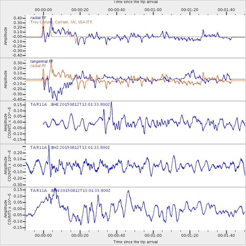
R11A Troy Canyon, Currant, NV, USA - Earthquake Result Viewer
*The percent match for this event was below the threshold and hence no stack was calculated.
| Earthquake location: |
Fiji Islands Region |
| Earthquake latitude/longitude: |
-16.5/-177.3 |
| Earthquake time(UTC): |
2015/08/12 (224) 12:50:43 GMT |
| Earthquake Depth: |
415 km |
| Earthquake Magnitude: |
5.3 MW |
| Earthquake Catalog/Contributor: |
ISC/ISC |
|
| Network: |
TA USArray Transportable Network (new EarthScope stations) |
| Station: |
R11A Troy Canyon, Currant, NV, USA |
| Lat/Lon: |
38.35 N/115.59 W |
| Elevation: |
1756 m |
|
| Distance: |
79.4 deg |
| Az: |
44.755 deg |
| Baz: |
239.216 deg |
| Ray Param: |
$rayparam |
*The percent match for this event was below the threshold and hence was not used in the summary stack. |
|
| Radial Match: |
38.431324 % |
| Radial Bump: |
400 |
| Transverse Match: |
32.037346 % |
| Transverse Bump: |
400 |
| SOD ConfigId: |
7422571 |
| Insert Time: |
2019-04-20 08:22:34.117 +0000 |
| GWidth: |
2.5 |
| Max Bumps: |
400 |
| Tol: |
0.001 |
|
Signal To Noise
| Channel | StoN | STA | LTA |
| TA:R11A: :BHZ:20150812T13:01:33.800Z | 1.7981902 | 1.1317925E-7 | 6.294064E-8 |
| TA:R11A: :BHN:20150812T13:01:33.800Z | 4.408018 | 1.06050294E-7 | 2.4058497E-8 |
| TA:R11A: :BHE:20150812T13:01:33.800Z | 1.6382091 | 5.5195468E-8 | 3.3692565E-8 |
| Arrivals |
| Ps | |
| PpPs | |
| PsPs/PpSs | |


