You are here: Home > Network List > US - United States National Seismic Network Stations List
> Station AMTX Amarillo, Texas, USA > Earthquake Result Viewer
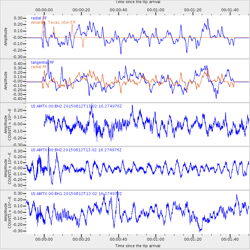
AMTX Amarillo, Texas, USA - Earthquake Result Viewer
*The percent match for this event was below the threshold and hence no stack was calculated.
| Earthquake location: |
Fiji Islands Region |
| Earthquake latitude/longitude: |
-16.5/-177.3 |
| Earthquake time(UTC): |
2015/08/12 (224) 12:50:43 GMT |
| Earthquake Depth: |
415 km |
| Earthquake Magnitude: |
5.3 MW |
| Earthquake Catalog/Contributor: |
ISC/ISC |
|
| Network: |
US United States National Seismic Network |
| Station: |
AMTX Amarillo, Texas, USA |
| Lat/Lon: |
34.53 N/101.41 W |
| Elevation: |
1010 m |
|
| Distance: |
88.0 deg |
| Az: |
53.227 deg |
| Baz: |
248.564 deg |
| Ray Param: |
$rayparam |
*The percent match for this event was below the threshold and hence was not used in the summary stack. |
|
| Radial Match: |
38.71853 % |
| Radial Bump: |
400 |
| Transverse Match: |
34.4048 % |
| Transverse Bump: |
400 |
| SOD ConfigId: |
7422571 |
| Insert Time: |
2019-04-20 08:23:17.879 +0000 |
| GWidth: |
2.5 |
| Max Bumps: |
400 |
| Tol: |
0.001 |
|
Signal To Noise
| Channel | StoN | STA | LTA |
| US:AMTX:00:BHZ:20150812T13:02:16.274976Z | 1.7991183 | 1.4378033E-7 | 7.991711E-8 |
| US:AMTX:00:BH1:20150812T13:02:16.274976Z | 1.0786227 | 1.1292535E-7 | 1.0469402E-7 |
| US:AMTX:00:BH2:20150812T13:02:16.274976Z | 1.3829305 | 9.824091E-8 | 7.103821E-8 |
| Arrivals |
| Ps | |
| PpPs | |
| PsPs/PpSs | |


