You are here: Home > Network List > WY - Yellowstone Wyoming Seismic Network Stations List
> Station YHH Holmes Hill, YNP, WY, USA > Earthquake Result Viewer
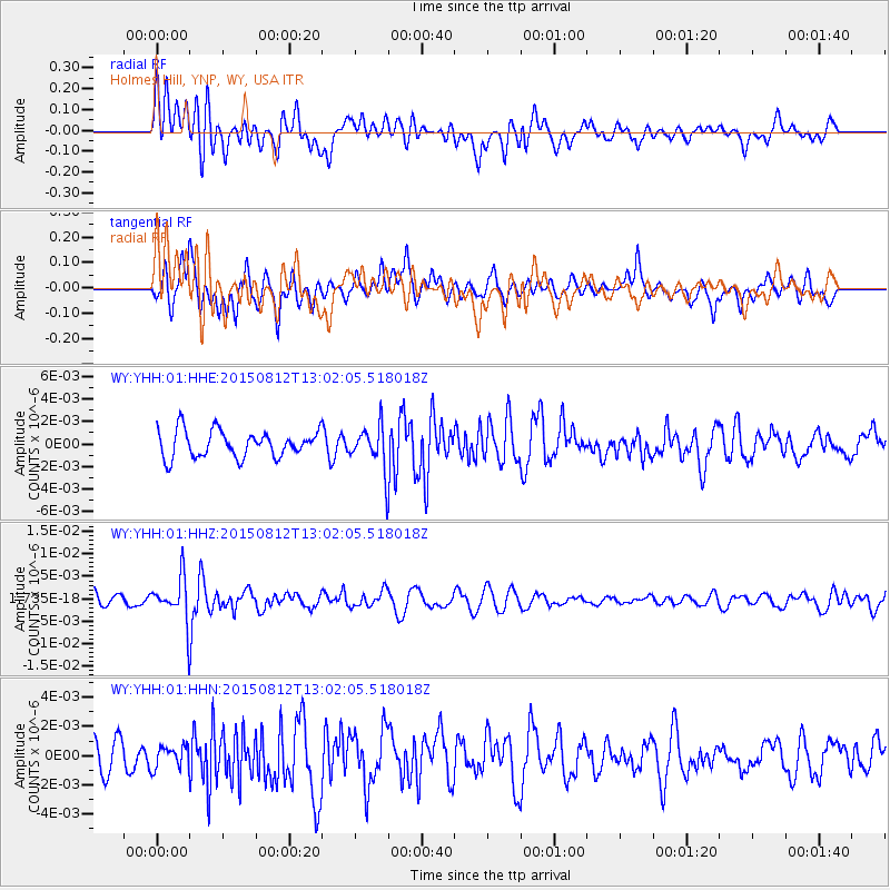
YHH Holmes Hill, YNP, WY, USA - Earthquake Result Viewer
*The percent match for this event was below the threshold and hence no stack was calculated.
| Earthquake location: |
Fiji Islands Region |
| Earthquake latitude/longitude: |
-16.5/-177.3 |
| Earthquake time(UTC): |
2015/08/12 (224) 12:50:43 GMT |
| Earthquake Depth: |
415 km |
| Earthquake Magnitude: |
5.3 MW |
| Earthquake Catalog/Contributor: |
ISC/ISC |
|
| Network: |
WY Yellowstone Wyoming Seismic Network |
| Station: |
YHH Holmes Hill, YNP, WY, USA |
| Lat/Lon: |
44.79 N/110.85 W |
| Elevation: |
2717 m |
|
| Distance: |
85.7 deg |
| Az: |
40.875 deg |
| Baz: |
241.847 deg |
| Ray Param: |
$rayparam |
*The percent match for this event was below the threshold and hence was not used in the summary stack. |
|
| Radial Match: |
47.708366 % |
| Radial Bump: |
400 |
| Transverse Match: |
49.745052 % |
| Transverse Bump: |
400 |
| SOD ConfigId: |
7422571 |
| Insert Time: |
2019-04-20 08:24:16.798 +0000 |
| GWidth: |
2.5 |
| Max Bumps: |
400 |
| Tol: |
0.001 |
|
Signal To Noise
| Channel | StoN | STA | LTA |
| WY:YHH:01:HHZ:20150812T13:02:05.518018Z | 2.6079865 | 4.8535793E-9 | 1.8610447E-9 |
| WY:YHH:01:HHN:20150812T13:02:05.518018Z | 0.5094879 | 7.580354E-10 | 1.4878377E-9 |
| WY:YHH:01:HHE:20150812T13:02:05.518018Z | 1.6272911 | 1.914486E-9 | 1.1764865E-9 |
| Arrivals |
| Ps | |
| PpPs | |
| PsPs/PpSs | |


