You are here: Home > Network List > US - United States National Seismic Network Stations List
> Station WMOK Wichita Mountains, Oklahoma, USA > Earthquake Result Viewer
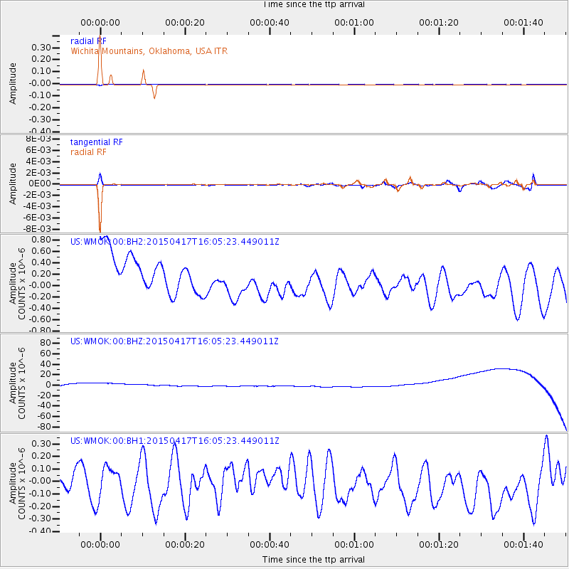
WMOK Wichita Mountains, Oklahoma, USA - Earthquake Result Viewer
*The percent match for this event was below the threshold and hence no stack was calculated.
| Earthquake location: |
Fiji Islands Region |
| Earthquake latitude/longitude: |
-15.9/-178.6 |
| Earthquake time(UTC): |
2015/04/17 (107) 15:52:51 GMT |
| Earthquake Depth: |
10 km |
| Earthquake Magnitude: |
6.5 MWW, 6.8 MI |
| Earthquake Catalog/Contributor: |
NEIC PDE/NEIC COMCAT |
|
| Network: |
US United States National Seismic Network |
| Station: |
WMOK Wichita Mountains, Oklahoma, USA |
| Lat/Lon: |
34.74 N/98.78 W |
| Elevation: |
486 m |
|
| Distance: |
90.8 deg |
| Az: |
54.157 deg |
| Baz: |
251.278 deg |
| Ray Param: |
$rayparam |
*The percent match for this event was below the threshold and hence was not used in the summary stack. |
|
| Radial Match: |
86.344315 % |
| Radial Bump: |
137 |
| Transverse Match: |
49.677364 % |
| Transverse Bump: |
400 |
| SOD ConfigId: |
872571 |
| Insert Time: |
2015-05-01 16:17:34.355 +0000 |
| GWidth: |
2.5 |
| Max Bumps: |
400 |
| Tol: |
0.001 |
|
Signal To Noise
| Channel | StoN | STA | LTA |
| US:WMOK:00:BHZ:20150417T16:05:23.449011Z | 1.08322 | 4.5980705E-5 | 4.244817E-5 |
| US:WMOK:00:BH1:20150417T16:05:23.449011Z | 1.6331909 | 1.2617637E-7 | 7.725758E-8 |
| US:WMOK:00:BH2:20150417T16:05:23.449011Z | 1.2422318 | 3.9089898E-7 | 3.1467474E-7 |
| Arrivals |
| Ps | |
| PpPs | |
| PsPs/PpSs | |


