You are here: Home > Network List > TA - USArray Transportable Network (new EarthScope stations) Stations List
> Station TPFO Pinon Flats, CA, USA > Earthquake Result Viewer
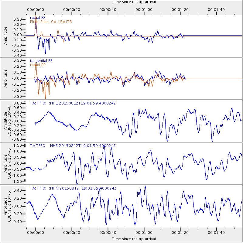
TPFO Pinon Flats, CA, USA - Earthquake Result Viewer
*The percent match for this event was below the threshold and hence no stack was calculated.
| Earthquake location: |
Solomon Islands |
| Earthquake latitude/longitude: |
-9.3/157.9 |
| Earthquake time(UTC): |
2015/08/12 (224) 18:49:23 GMT |
| Earthquake Depth: |
5.0 km |
| Earthquake Magnitude: |
6.4 MWB, 6.8 MI, 6.9 MI |
| Earthquake Catalog/Contributor: |
NEIC PDE/NEIC COMCAT |
|
| Network: |
TA USArray Transportable Network (new EarthScope stations) |
| Station: |
TPFO Pinon Flats, CA, USA |
| Lat/Lon: |
33.61 N/116.45 W |
| Elevation: |
1275 m |
|
| Distance: |
91.5 deg |
| Az: |
56.346 deg |
| Baz: |
259.867 deg |
| Ray Param: |
$rayparam |
*The percent match for this event was below the threshold and hence was not used in the summary stack. |
|
| Radial Match: |
93.23341 % |
| Radial Bump: |
382 |
| Transverse Match: |
54.550713 % |
| Transverse Bump: |
400 |
| SOD ConfigId: |
7422571 |
| Insert Time: |
2019-04-20 08:37:50.385 +0000 |
| GWidth: |
2.5 |
| Max Bumps: |
400 |
| Tol: |
0.001 |
|
Signal To Noise
| Channel | StoN | STA | LTA |
| TA:TPFO: :HHZ:20150812T19:01:59.400024Z | 1.4601123 | 4.4174976E-7 | 3.0254503E-7 |
| TA:TPFO: :HHN:20150812T19:01:59.400024Z | 1.994066 | 2.090849E-7 | 1.04853555E-7 |
| TA:TPFO: :HHE:20150812T19:01:59.400024Z | 1.1480511 | 2.708269E-7 | 2.3590141E-7 |
| Arrivals |
| Ps | |
| PpPs | |
| PsPs/PpSs | |


