PMSA Palmer Station, Antarctica - Earthquake Result Viewer
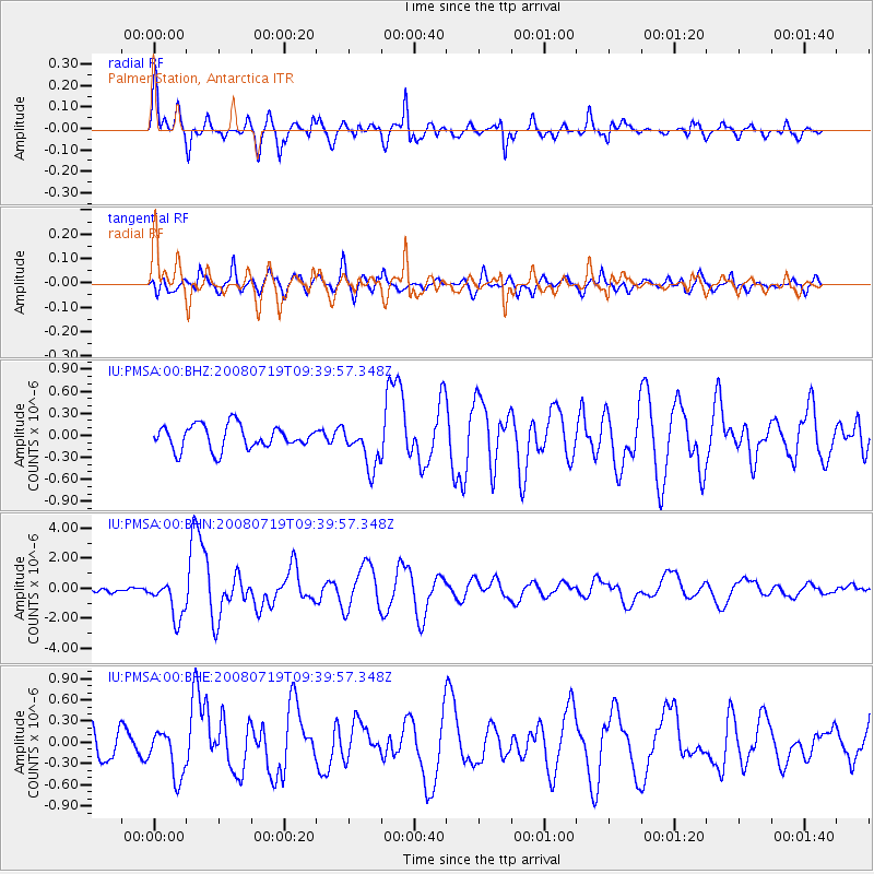
Earthquake location: Santa Cruz Islands Region
Earthquake latitude/longitude: -11.0/164.5
Earthquake time(UTC): 2008/07/19 (201) 09:27:01 GMT
Earthquake Depth: 11 km
Earthquake Magnitude: 6.1 MB, 6.4 MS, 6.6 MW, 6.6 MW
Earthquake Catalog/Contributor: WHDF/NEIC
Network: IU Global Seismograph Network (GSN - IRIS/USGS)
Station: PMSA Palmer Station, Antarctica
Lat/Lon: 64.77 S/64.05 W
Elevation: 40 m
Distance: 96.1 deg
Az: 161.156 deg
Baz: 227.728 deg
Ray Param: 0.040600583
Estimated Moho Depth: 27.5 km
Estimated Crust Vp/Vs: 1.85
Assumed Crust Vp: 6.183 km/s
Estimated Crust Vs: 3.346 km/s
Estimated Crust Poisson's Ratio: 0.29
Radial Match: 84.94553 %
Radial Bump: 400
Transverse Match: 72.260826 %
Transverse Bump: 400
SOD ConfigId: 2658
Insert Time: 2010-03-04 15:26:25.222 +0000
GWidth: 2.5
Max Bumps: 400
Tol: 0.001

Signal To Noise

ChannelStoNSTALTA
IU:PMSA:00:BHN:20080719T09:39:57.348Z4.9077121.286192E-62.6207567E-7
IU:PMSA:00:BHE:20080719T09:39:57.348Z1.40519493.311685E-72.3567442E-7
IU:PMSA:00:BHZ:20080719T09:39:57.348Z1.80474462.91678E-71.6161734E-7
Arrivals
Ps3.8 SECOND
PpPs12 SECOND
PsPs/PpSs16 SECOND