PMSA Palmer Station, Antarctica - Earthquake Result Viewer
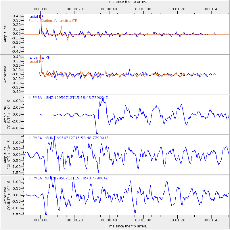
Earthquake location: Southeast Of Loyalty Islands
Earthquake latitude/longitude: -23.2/170.8
Earthquake time(UTC): 1995/07/12 (193) 15:46:59 GMT
Earthquake Depth: 33 km
Earthquake Magnitude: 5.9 MB, 6.4 MS, 6.5 UNKNOWN, 6.4 MW
Earthquake Catalog/Contributor: WHDF/NEIC
Network: IU Global Seismograph Network (GSN - IRIS/USGS)
Station: PMSA Palmer Station, Antarctica
Lat/Lon: 64.77 S/64.05 W
Elevation: 40 m
Distance: 82.7 deg
Az: 159.306 deg
Baz: 229.334 deg
Ray Param: 0.046685014
Estimated Moho Depth: 25.0 km
Estimated Crust Vp/Vs: 1.98
Assumed Crust Vp: 6.183 km/s
Estimated Crust Vs: 3.13 km/s
Estimated Crust Poisson's Ratio: 0.33
Radial Match: 92.95142 %
Radial Bump: 400
Transverse Match: 81.20863 %
Transverse Bump: 400
SOD ConfigId: 6273
Insert Time: 2010-03-04 15:26:41.778 +0000
GWidth: 2.5
Max Bumps: 400
Tol: 0.001

Signal To Noise

ChannelStoNSTALTA
IU:PMSA: :BHN:19950712T15:58:48.779004Z3.427436.888061E-72.009687E-7
IU:PMSA: :BHE:19950712T15:58:48.779004Z7.9686196.794921E-78.527099E-8
IU:PMSA: :BHZ:19950712T15:58:48.779004Z12.0674762.8111847E-62.3295547E-7
Arrivals
Ps4.0 SECOND
PpPs12 SECOND
PsPs/PpSs16 SECOND