
PMSA Palmer Station, Antarctica - Earthquake Result Viewer
| ||||||||||||||||||
| ||||||||||||||||||
| ||||||||||||||||||
|
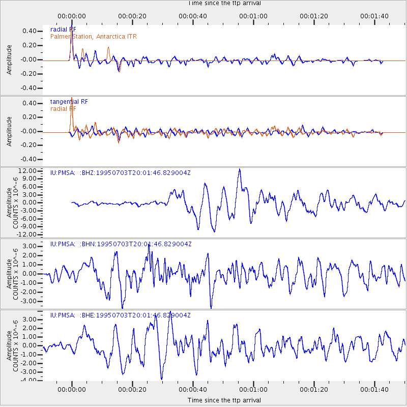
Signal To Noise
| Channel | StoN | STA | LTA |
| IU:PMSA: :BHN:19950703T20:01:46.829004Z | 1.8658947 | 7.6083796E-7 | 4.077604E-7 |
| IU:PMSA: :BHE:19950703T20:01:46.829004Z | 3.6155105 | 1.170788E-6 | 3.238237E-7 |
| IU:PMSA: :BHZ:19950703T20:01:46.829004Z | 6.5817018 | 2.7204742E-6 | 4.1333902E-7 |
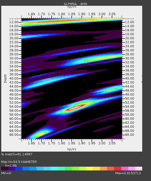
| Arrivals | |
| Ps | 7.8 SECOND |
| PpPs | 24 SECOND |
| PsPs/PpSs | 32 SECOND |

