PMSA Palmer Station, Antarctica - Earthquake Result Viewer
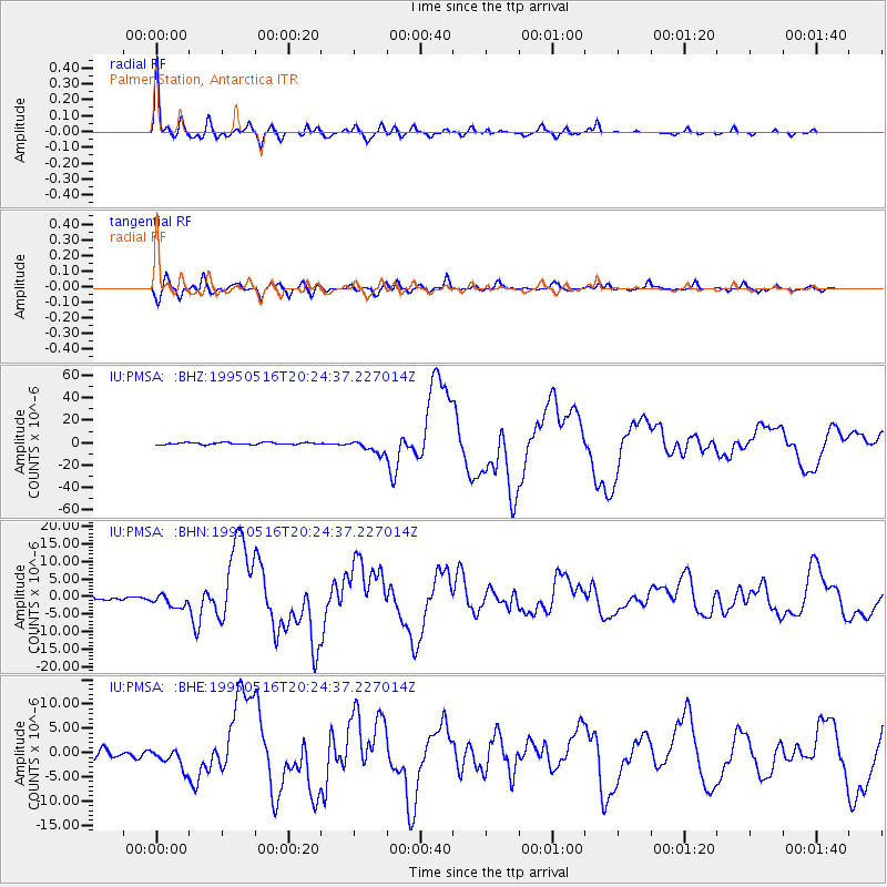
Earthquake location: Southeast Of Loyalty Islands
Earthquake latitude/longitude: -23.0/169.9
Earthquake time(UTC): 1995/05/16 (136) 20:12:45 GMT
Earthquake Depth: 33 km
Earthquake Magnitude: 6.8 MB, 7.7 MS, 7.7 UNKNOWN, 7.7 MW
Earthquake Catalog/Contributor: WHDF/NEIC
Network: IU Global Seismograph Network (GSN - IRIS/USGS)
Station: PMSA Palmer Station, Antarctica
Lat/Lon: 64.77 S/64.05 W
Elevation: 40 m
Distance: 83.2 deg
Az: 159.58 deg
Baz: 228.604 deg
Ray Param: 0.04633134
Estimated Moho Depth: 27.0 km
Estimated Crust Vp/Vs: 1.84
Assumed Crust Vp: 6.183 km/s
Estimated Crust Vs: 3.356 km/s
Estimated Crust Poisson's Ratio: 0.29
Radial Match: 98.03998 %
Radial Bump: 372
Transverse Match: 85.70441 %
Transverse Bump: 400
SOD ConfigId: 6273
Insert Time: 2010-03-04 15:26:45.971 +0000
GWidth: 2.5
Max Bumps: 400
Tol: 0.001

Signal To Noise

ChannelStoNSTALTA
IU:PMSA: :BHN:19950516T20:24:37.227014Z2.58708741.8706462E-67.2307034E-7
IU:PMSA: :BHE:19950516T20:24:37.227014Z2.2553732.021688E-68.9638746E-7
IU:PMSA: :BHZ:19950516T20:24:37.227014Z6.646936.073222E-69.136882E-7
Arrivals
Ps3.8 SECOND
PpPs12 SECOND
PsPs/PpSs16 SECOND