PMSA Palmer Station, Antarctica - Earthquake Result Viewer
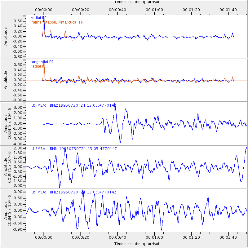
Earthquake location: Near Coast Of Northern Chile
Earthquake latitude/longitude: -23.3/-70.6
Earthquake time(UTC): 1995/07/30 (211) 21:05:50 GMT
Earthquake Depth: 33 km
Earthquake Magnitude: 5.6 MB, 5.6 MS, 5.4 UNKNOWN, 6.1 MW
Earthquake Catalog/Contributor: WHDF/NEIC
Network: IU Global Seismograph Network (GSN - IRIS/USGS)
Station: PMSA Palmer Station, Antarctica
Lat/Lon: 64.77 S/64.05 W
Elevation: 40 m
Distance: 41.7 deg
Az: 175.789 deg
Baz: 350.937 deg
Ray Param: 0.073577486
Estimated Moho Depth: 32.75 km
Estimated Crust Vp/Vs: 1.69
Assumed Crust Vp: 6.183 km/s
Estimated Crust Vs: 3.669 km/s
Estimated Crust Poisson's Ratio: 0.23
Radial Match: 91.166504 %
Radial Bump: 330
Transverse Match: 84.923134 %
Transverse Bump: 400
SOD ConfigId: 6273
Insert Time: 2010-03-04 15:26:50.217 +0000
GWidth: 2.5
Max Bumps: 400
Tol: 0.001

Signal To Noise

ChannelStoNSTALTA
IU:PMSA: :BHN:19950730T21:13:05.477014Z4.8898553.6869847E-77.54007E-8
IU:PMSA: :BHE:19950730T21:13:05.477014Z1.35790411.0251627E-77.5495954E-8
IU:PMSA: :BHZ:19950730T21:13:05.477014Z7.2855666.9786785E-79.578773E-8
Arrivals
Ps3.9 SECOND
PpPs13 SECOND
PsPs/PpSs17 SECOND