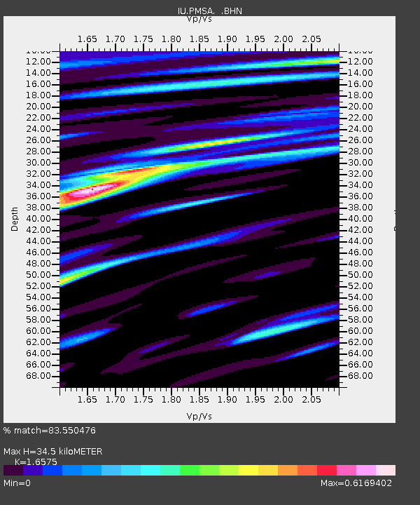
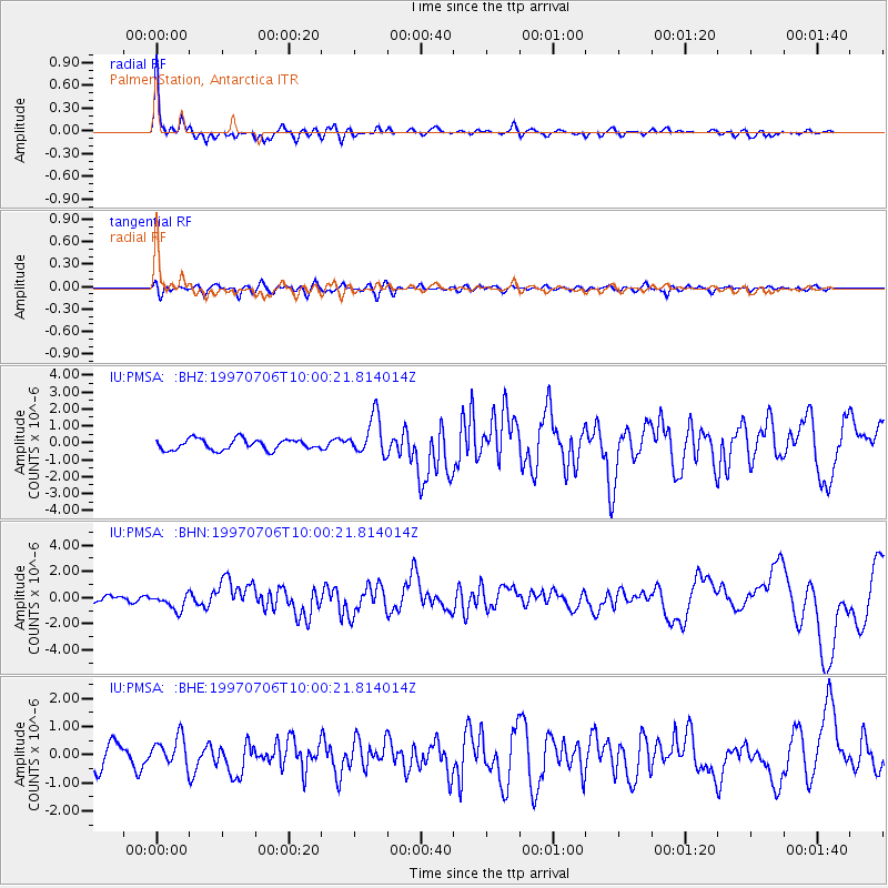
PMSA Palmer Station, Antarctica - Earthquake Result Viewer

Earthquake location: Near Coast Of Central Chile
Earthquake latitude/longitude: -30.1/-71.9
Earthquake time(UTC): 1997/07/06 (187) 09:54:00 GMT
Earthquake Depth: 19 km
Earthquake Magnitude: 5.8 MB, 6.5 MS, 6.8 UNKNOWN, 6.4 ME
Earthquake Catalog/Contributor: WHDF/NEIC
Network: IU Global Seismograph Network (GSN - IRIS/USGS)
Station: PMSA Palmer Station, Antarctica
Lat/Lon: 64.77 S/64.05 W
Elevation: 40 m
Distance: 35.1 deg
Az: 174.175 deg
Baz: 348.151 deg
Ray Param: 0.077388376
Estimated Moho Depth: 34.5 km
Estimated Crust Vp/Vs: 1.66
Assumed Crust Vp: 6.183 km/s
Estimated Crust Vs: 3.73 km/s
Estimated Crust Poisson's Ratio: 0.21
Radial Match: 83.550476 %
Radial Bump: 400
Transverse Match: 48.24187 %
Transverse Bump: 400
SOD ConfigId: 6273
Insert Time: 2010-03-04 15:27:04.272 +0000
GWidth: 2.5
Max Bumps: 400
Tol: 0.001

Signal To Noise

ChannelStoNSTALTA
IU:PMSA: :BHN:19970706T10:00:21.814014Z3.25207956.3053625E-71.938871E-7
IU:PMSA: :BHE:19970706T10:00:21.814014Z0.759058365.1094804E-76.73134E-7
IU:PMSA: :BHZ:19970706T10:00:21.814014Z3.62416461.1553656E-63.18795E-7
Arrivals
Ps4.0 SECOND
PpPs14 SECOND
PsPs/PpSs18 SECOND