PMSA Palmer Station, Antarctica - Earthquake Result Viewer
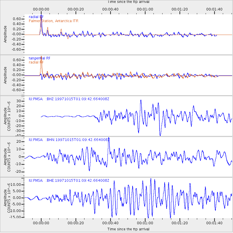
Earthquake location: Near Coast Of Central Chile
Earthquake latitude/longitude: -30.9/-71.2
Earthquake time(UTC): 1997/10/15 (288) 01:03:33 GMT
Earthquake Depth: 58 km
Earthquake Magnitude: 6.8 MB, 6.8 MS, 7.3 UNKNOWN, 7.1 MW
Earthquake Catalog/Contributor: WHDF/NEIC
Network: IU Global Seismograph Network (GSN - IRIS/USGS)
Station: PMSA Palmer Station, Antarctica
Lat/Lon: 64.77 S/64.05 W
Elevation: 40 m
Distance: 34.2 deg
Az: 174.533 deg
Baz: 348.986 deg
Ray Param: 0.07773469
Estimated Moho Depth: 27.75 km
Estimated Crust Vp/Vs: 1.76
Assumed Crust Vp: 6.183 km/s
Estimated Crust Vs: 3.513 km/s
Estimated Crust Poisson's Ratio: 0.26
Radial Match: 88.72238 %
Radial Bump: 400
Transverse Match: 82.8929 %
Transverse Bump: 400
SOD ConfigId: 6273
Insert Time: 2010-03-04 15:27:11.419 +0000
GWidth: 2.5
Max Bumps: 400
Tol: 0.001

Signal To Noise

ChannelStoNSTALTA
IU:PMSA: :BHN:19971015T01:09:42.664008Z2.0212542.0150467E-69.96929E-7
IU:PMSA: :BHE:19971015T01:09:42.664008Z0.51732457.117921E-71.3759103E-6
IU:PMSA: :BHZ:19971015T01:09:42.664008Z5.58292534.8015386E-68.600399E-7
Arrivals
Ps3.7 SECOND
PpPs12 SECOND
PsPs/PpSs15 SECOND