You are here: Home > Network List > GS - US Geological Survey Networks Stations List
> Station KAN10 Keim Farm > Earthquake Result Viewer
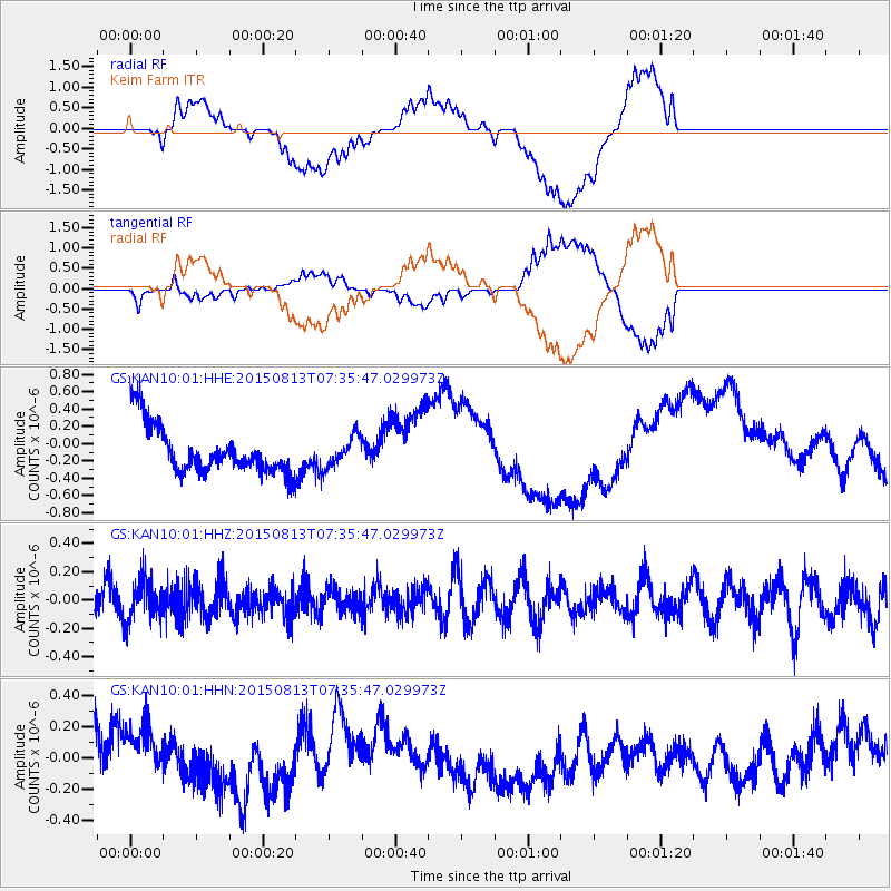
KAN10 Keim Farm - Earthquake Result Viewer
*The percent match for this event was below the threshold and hence no stack was calculated.
| Earthquake location: |
Kuril Islands |
| Earthquake latitude/longitude: |
46.3/152.0 |
| Earthquake time(UTC): |
2015/08/13 (225) 07:24:40 GMT |
| Earthquake Depth: |
80 km |
| Earthquake Magnitude: |
4.6 mb |
| Earthquake Catalog/Contributor: |
ISC/ISC |
|
| Network: |
GS US Geological Survey Networks |
| Station: |
KAN10 Keim Farm |
| Lat/Lon: |
37.12 N/98.10 W |
| Elevation: |
417 m |
|
| Distance: |
75.9 deg |
| Az: |
50.815 deg |
| Baz: |
317.742 deg |
| Ray Param: |
$rayparam |
*The percent match for this event was below the threshold and hence was not used in the summary stack. |
|
| Radial Match: |
49.117535 % |
| Radial Bump: |
400 |
| Transverse Match: |
48.81296 % |
| Transverse Bump: |
400 |
| SOD ConfigId: |
7422571 |
| Insert Time: |
2019-04-20 08:44:14.220 +0000 |
| GWidth: |
2.5 |
| Max Bumps: |
400 |
| Tol: |
0.001 |
|
Signal To Noise
| Channel | StoN | STA | LTA |
| GS:KAN10:01:HHZ:20150813T07:35:47.029973Z | 1.1702787 | 1.4668915E-7 | 1.2534548E-7 |
| GS:KAN10:01:HHN:20150813T07:35:47.029973Z | 1.2182561 | 2.0007667E-7 | 1.6423202E-7 |
| GS:KAN10:01:HHE:20150813T07:35:47.029973Z | 0.622901 | 1.7352014E-7 | 2.7856777E-7 |
| Arrivals |
| Ps | |
| PpPs | |
| PsPs/PpSs | |


