You are here: Home > Network List > IU - Global Seismograph Network (GSN - IRIS/USGS) Stations List
> Station PMSA Palmer Station, Antarctica > Earthquake Result Viewer
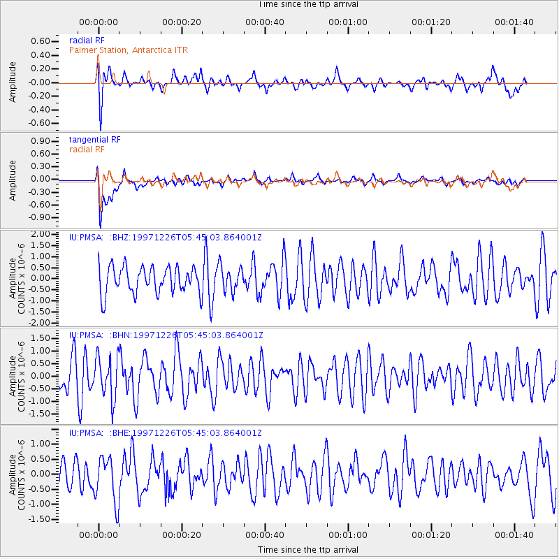
PMSA Palmer Station, Antarctica - Earthquake Result Viewer
*The percent match for this event was below the threshold and hence no stack was calculated.
| Earthquake location: |
South Of Fiji Islands |
| Earthquake latitude/longitude: |
-22.3/-179.7 |
| Earthquake time(UTC): |
1997/12/26 (360) 05:34:24 GMT |
| Earthquake Depth: |
588 km |
| Earthquake Magnitude: |
5.9 UNKNOWN, 5.3 MB, 5.8 MW |
| Earthquake Catalog/Contributor: |
WHDF/NEIC |
|
| Network: |
IU Global Seismograph Network (GSN - IRIS/USGS) |
| Station: |
PMSA Palmer Station, Antarctica |
| Lat/Lon: |
64.77 S/64.05 W |
| Elevation: |
40 m |
|
| Distance: |
80.2 deg |
| Az: |
156.92 deg |
| Baz: |
237.883 deg |
| Ray Param: |
$rayparam |
*The percent match for this event was below the threshold and hence was not used in the summary stack. |
|
| Radial Match: |
67.69226 % |
| Radial Bump: |
400 |
| Transverse Match: |
70.45606 % |
| Transverse Bump: |
400 |
| SOD ConfigId: |
4480 |
| Insert Time: |
2010-03-04 15:28:35.126 +0000 |
| GWidth: |
2.5 |
| Max Bumps: |
400 |
| Tol: |
0.001 |
|
Signal To Noise
| Channel | StoN | STA | LTA |
| IU:PMSA: :BHN:19971226T05:45:03.864001Z | 1.1265485 | 8.5373404E-7 | 7.578316E-7 |
| IU:PMSA: :BHE:19971226T05:45:03.864001Z | 1.4062424 | 7.964423E-7 | 5.66362E-7 |
| IU:PMSA: :BHZ:19971226T05:45:03.864001Z | 0.91949505 | 5.5102987E-7 | 5.992744E-7 |
| Arrivals |
| Ps | |
| PpPs | |
| PsPs/PpSs | |


