You are here: Home > Network List > IU - Global Seismograph Network (GSN - IRIS/USGS) Stations List
> Station PMSA Palmer Station, Antarctica > Earthquake Result Viewer
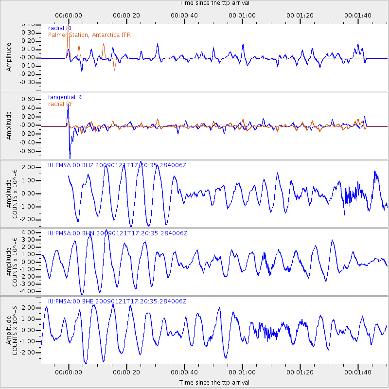
PMSA Palmer Station, Antarctica - Earthquake Result Viewer
*The percent match for this event was below the threshold and hence no stack was calculated.
| Earthquake location: |
Southeast Of Loyalty Islands |
| Earthquake latitude/longitude: |
-22.7/171.0 |
| Earthquake time(UTC): |
2009/01/21 (021) 17:08:42 GMT |
| Earthquake Depth: |
24 km |
| Earthquake Magnitude: |
5.8 MS, 5.4 MB, 6.1 MW, 6.1 MW |
| Earthquake Catalog/Contributor: |
WHDF/NEIC |
|
| Network: |
IU Global Seismograph Network (GSN - IRIS/USGS) |
| Station: |
PMSA Palmer Station, Antarctica |
| Lat/Lon: |
64.77 S/64.05 W |
| Elevation: |
40 m |
|
| Distance: |
83.1 deg |
| Az: |
159.269 deg |
| Baz: |
229.718 deg |
| Ray Param: |
$rayparam |
*The percent match for this event was below the threshold and hence was not used in the summary stack. |
|
| Radial Match: |
53.269154 % |
| Radial Bump: |
396 |
| Transverse Match: |
57.488373 % |
| Transverse Bump: |
400 |
| SOD ConfigId: |
2834 |
| Insert Time: |
2010-03-04 15:28:50.881 +0000 |
| GWidth: |
2.5 |
| Max Bumps: |
400 |
| Tol: |
0.001 |
|
Signal To Noise
| Channel | StoN | STA | LTA |
| IU:PMSA:00:BHN:20090121T17:20:35.284006Z | 2.9389687 | 2.412156E-6 | 8.2074905E-7 |
| IU:PMSA:00:BHE:20090121T17:20:35.284006Z | 0.68297166 | 9.456338E-7 | 1.3845872E-6 |
| IU:PMSA:00:BHZ:20090121T17:20:35.284006Z | 1.1710918 | 1.6038455E-6 | 1.3695301E-6 |
| Arrivals |
| Ps | |
| PpPs | |
| PsPs/PpSs | |


