You are here: Home > Network List > US - United States National Seismic Network Stations List
> Station EGMT Eagleton, Montana, USA > Earthquake Result Viewer
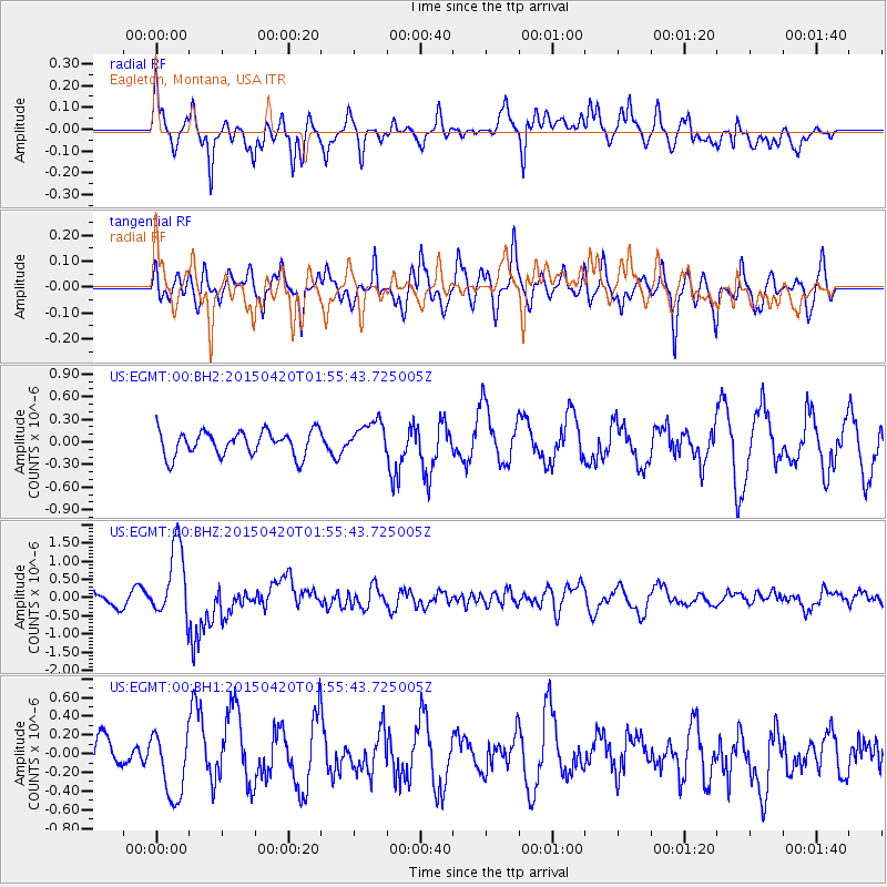
EGMT Eagleton, Montana, USA - Earthquake Result Viewer
*The percent match for this event was below the threshold and hence no stack was calculated.
| Earthquake location: |
Taiwan Region |
| Earthquake latitude/longitude: |
24.1/122.3 |
| Earthquake time(UTC): |
2015/04/20 (110) 01:42:58 GMT |
| Earthquake Depth: |
29 km |
| Earthquake Magnitude: |
6.6 MWP, 6.6 MI |
| Earthquake Catalog/Contributor: |
NEIC PDE/NEIC COMCAT |
|
| Network: |
US United States National Seismic Network |
| Station: |
EGMT Eagleton, Montana, USA |
| Lat/Lon: |
48.02 N/109.75 W |
| Elevation: |
1055 m |
|
| Distance: |
94.3 deg |
| Az: |
32.083 deg |
| Baz: |
313.705 deg |
| Ray Param: |
$rayparam |
*The percent match for this event was below the threshold and hence was not used in the summary stack. |
|
| Radial Match: |
74.84673 % |
| Radial Bump: |
400 |
| Transverse Match: |
76.21017 % |
| Transverse Bump: |
400 |
| SOD ConfigId: |
872571 |
| Insert Time: |
2015-05-04 01:53:25.277 +0000 |
| GWidth: |
2.5 |
| Max Bumps: |
400 |
| Tol: |
0.001 |
|
Signal To Noise
| Channel | StoN | STA | LTA |
| US:EGMT:00:BHZ:20150420T01:55:43.725005Z | 6.2958546 | 9.982058E-7 | 1.5854968E-7 |
| US:EGMT:00:BH1:20150420T01:55:43.725005Z | 1.714356 | 3.605281E-7 | 2.1029946E-7 |
| US:EGMT:00:BH2:20150420T01:55:43.725005Z | 1.3498802 | 2.2095612E-7 | 1.6368571E-7 |
| Arrivals |
| Ps | |
| PpPs | |
| PsPs/PpSs | |


