You are here: Home > Network List > CI - Caltech Regional Seismic Network Stations List
> Station GLA Glamis, California, USA > Earthquake Result Viewer
GLA Glamis, California, USA - Earthquake Result Viewer
*The percent match for this event was below the threshold and hence no stack was calculated.
| Earthquake location: |
Mariana Islands |
| Earthquake latitude/longitude: |
19.3/145.6 |
| Earthquake time(UTC): |
1999/06/23 (174) 19:37:22 GMT |
| Earthquake Depth: |
103 km |
| Earthquake Magnitude: |
5.5 MB, 4.9 MS |
| Earthquake Catalog/Contributor: |
WHDF/NEIC |
|
| Network: |
CI Caltech Regional Seismic Network |
| Station: |
GLA Glamis, California, USA |
| Lat/Lon: |
33.05 N/114.83 W |
| Elevation: |
627 m |
|
| Distance: |
87.4 deg |
| Az: |
55.992 deg |
| Baz: |
291.193 deg |
| Ray Param: |
$rayparam |
*The percent match for this event was below the threshold and hence was not used in the summary stack. |
|
| Radial Match: |
59.316433 % |
| Radial Bump: |
400 |
| Transverse Match: |
61.490326 % |
| Transverse Bump: |
400 |
| SOD ConfigId: |
4480 |
| Insert Time: |
2010-02-25 23:35:59.842 +0000 |
| GWidth: |
2.5 |
| Max Bumps: |
400 |
| Tol: |
0.001 |
|
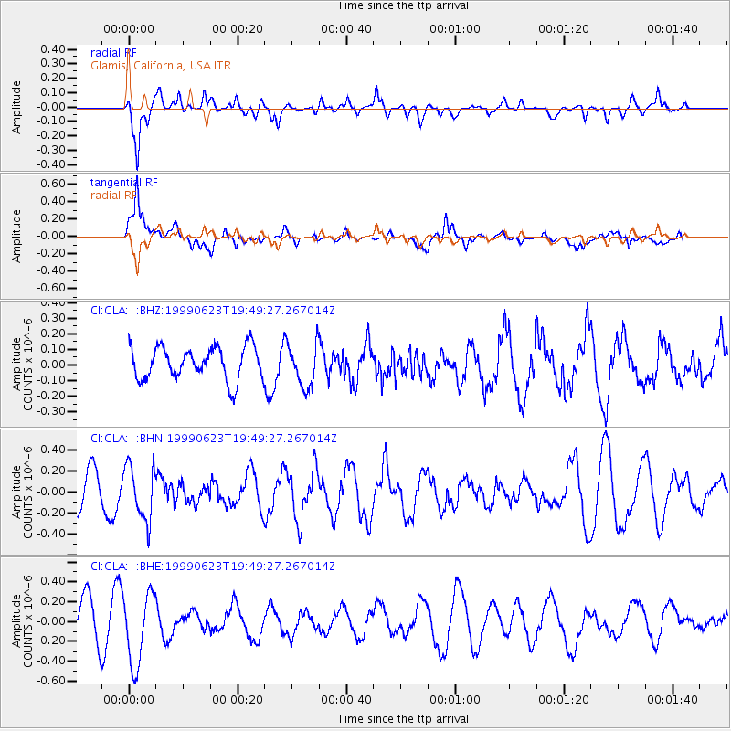
Signal To Noise
| Channel | StoN | STA | LTA |
| CI:GLA: :BHN:19990623T19:49:27.267014Z | 1.8005505 | 2.5923427E-7 | 1.43975E-7 |
| CI:GLA: :BHE:19990623T19:49:27.267014Z | 1.7227995 | 3.5783535E-7 | 2.0770572E-7 |
| CI:GLA: :BHZ:19990623T19:49:27.267014Z | 1.3224221 | 1.375659E-7 | 1.0402571E-7 |
| Arrivals |
| Ps | |
| PpPs | |
| PsPs/PpSs | |


