You are here: Home > Network List > CI - Caltech Regional Seismic Network Stations List
> Station GLA Glamis, Glamis, CA, USA > Earthquake Result Viewer
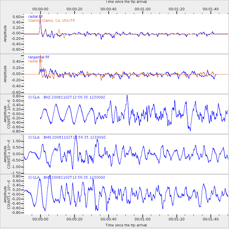
GLA Glamis, Glamis, CA, USA - Earthquake Result Viewer
*The percent match for this event was below the threshold and hence no stack was calculated.
| Earthquake location: |
Andreanof Islands, Aleutian Is. |
| Earthquake latitude/longitude: |
51.6/-174.4 |
| Earthquake time(UTC): |
2008/11/02 (307) 13:48:42 GMT |
| Earthquake Depth: |
36 km |
| Earthquake Magnitude: |
5.7 MB, 5.8 MS, 6.1 MW, 6.1 MW |
| Earthquake Catalog/Contributor: |
WHDF/NEIC |
|
| Network: |
CI Caltech Regional Seismic Network |
| Station: |
GLA Glamis, Glamis, CA, USA |
| Lat/Lon: |
33.05 N/114.83 W |
| Elevation: |
610 m |
|
| Distance: |
46.4 deg |
| Az: |
89.498 deg |
| Baz: |
311.978 deg |
| Ray Param: |
$rayparam |
*The percent match for this event was below the threshold and hence was not used in the summary stack. |
|
| Radial Match: |
76.975845 % |
| Radial Bump: |
400 |
| Transverse Match: |
53.21003 % |
| Transverse Bump: |
400 |
| SOD ConfigId: |
2658 |
| Insert Time: |
2010-02-25 23:36:01.173 +0000 |
| GWidth: |
2.5 |
| Max Bumps: |
400 |
| Tol: |
0.001 |
|
Signal To Noise
| Channel | StoN | STA | LTA |
| CI:GLA: :BHN:20081102T13:56:35.123009Z | 1.6334205 | 4.7910305E-7 | 2.9331275E-7 |
| CI:GLA: :BHE:20081102T13:56:35.123009Z | 2.0342963 | 5.0620935E-7 | 2.4883758E-7 |
| CI:GLA: :BHZ:20081102T13:56:35.123009Z | 0.85500896 | 2.2000461E-7 | 2.5731262E-7 |
| Arrivals |
| Ps | |
| PpPs | |
| PsPs/PpSs | |


