You are here: Home > Network List > CN - Canadian National Seismograph Network Stations List
> Station INK INUVIK, NT > Earthquake Result Viewer
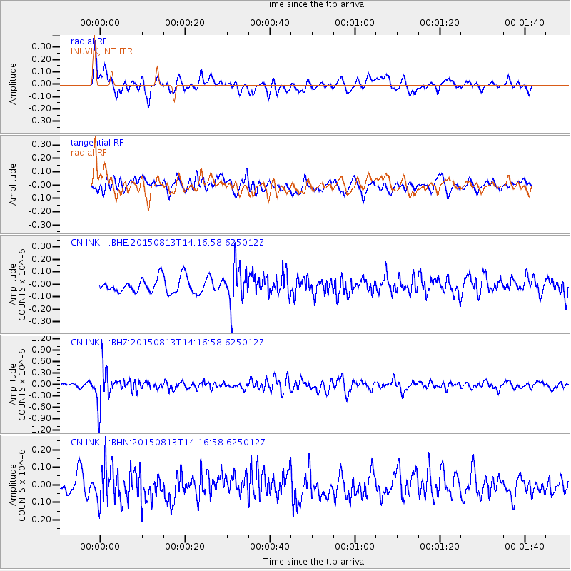
INK INUVIK, NT - Earthquake Result Viewer
*The percent match for this event was below the threshold and hence no stack was calculated.
| Earthquake location: |
New Ireland Region, P.N.G. |
| Earthquake latitude/longitude: |
-3.9/152.9 |
| Earthquake time(UTC): |
2015/08/13 (225) 14:04:58 GMT |
| Earthquake Depth: |
137 km |
| Earthquake Magnitude: |
5.6 MB |
| Earthquake Catalog/Contributor: |
NEIC PDE/NEIC ALERT |
|
| Network: |
CN Canadian National Seismograph Network |
| Station: |
INK INUVIK, NT |
| Lat/Lon: |
68.31 N/133.53 W |
| Elevation: |
44 m |
|
| Distance: |
87.6 deg |
| Az: |
20.911 deg |
| Baz: |
253.285 deg |
| Ray Param: |
$rayparam |
*The percent match for this event was below the threshold and hence was not used in the summary stack. |
|
| Radial Match: |
64.399796 % |
| Radial Bump: |
400 |
| Transverse Match: |
58.63025 % |
| Transverse Bump: |
400 |
| SOD ConfigId: |
7422571 |
| Insert Time: |
2019-04-20 09:04:52.303 +0000 |
| GWidth: |
2.5 |
| Max Bumps: |
400 |
| Tol: |
0.001 |
|
Signal To Noise
| Channel | StoN | STA | LTA |
| CN:INK: :BHZ:20150813T14:16:58.625012Z | 5.335582 | 4.8911085E-7 | 9.166964E-8 |
| CN:INK: :BHN:20150813T14:16:58.625012Z | 2.1711316 | 1.07144515E-7 | 4.9349616E-8 |
| CN:INK: :BHE:20150813T14:16:58.625012Z | 2.5930836 | 1.63046E-7 | 6.287726E-8 |
| Arrivals |
| Ps | |
| PpPs | |
| PsPs/PpSs | |


