You are here: Home > Network List > WY - Yellowstone Wyoming Seismic Network Stations List
> Station YHH Holmes Hill, YNP, WY, USA > Earthquake Result Viewer
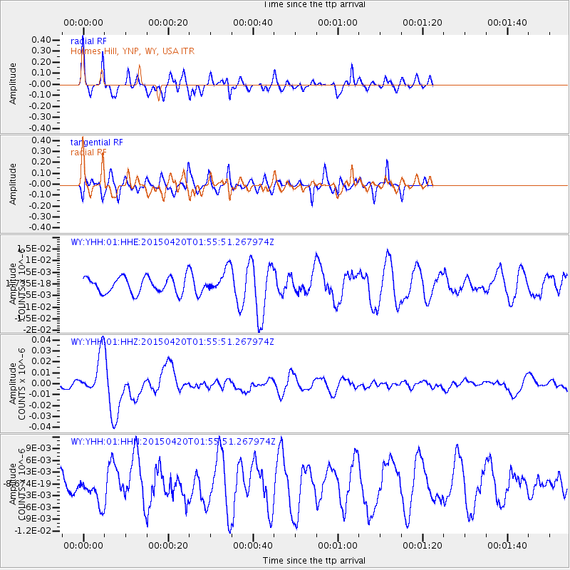
YHH Holmes Hill, YNP, WY, USA - Earthquake Result Viewer
*The percent match for this event was below the threshold and hence no stack was calculated.
| Earthquake location: |
Taiwan Region |
| Earthquake latitude/longitude: |
24.1/122.3 |
| Earthquake time(UTC): |
2015/04/20 (110) 01:42:58 GMT |
| Earthquake Depth: |
29 km |
| Earthquake Magnitude: |
6.6 MWP, 6.6 MI |
| Earthquake Catalog/Contributor: |
NEIC PDE/NEIC COMCAT |
|
| Network: |
WY Yellowstone Wyoming Seismic Network |
| Station: |
YHH Holmes Hill, YNP, WY, USA |
| Lat/Lon: |
44.79 N/110.85 W |
| Elevation: |
2717 m |
|
| Distance: |
96.0 deg |
| Az: |
34.974 deg |
| Baz: |
312.654 deg |
| Ray Param: |
$rayparam |
*The percent match for this event was below the threshold and hence was not used in the summary stack. |
|
| Radial Match: |
77.136086 % |
| Radial Bump: |
376 |
| Transverse Match: |
74.42864 % |
| Transverse Bump: |
400 |
| SOD ConfigId: |
872571 |
| Insert Time: |
2015-05-04 01:53:57.830 +0000 |
| GWidth: |
2.5 |
| Max Bumps: |
400 |
| Tol: |
0.001 |
|
Signal To Noise
| Channel | StoN | STA | LTA |
| WY:YHH:01:HHZ:20150420T01:55:51.267974Z | 4.5675077 | 1.8877786E-8 | 4.1330606E-9 |
| WY:YHH:01:HHN:20150420T01:55:51.267974Z | 1.8151172 | 3.5757661E-9 | 1.969992E-9 |
| WY:YHH:01:HHE:20150420T01:55:51.267974Z | 1.4577059 | 5.059463E-9 | 3.4708394E-9 |
| Arrivals |
| Ps | |
| PpPs | |
| PsPs/PpSs | |


