You are here: Home > Network List > UW - Pacific Northwest Regional Seismic Network Stations List
> Station UMAT Pilot Rock, OR, USA > Earthquake Result Viewer
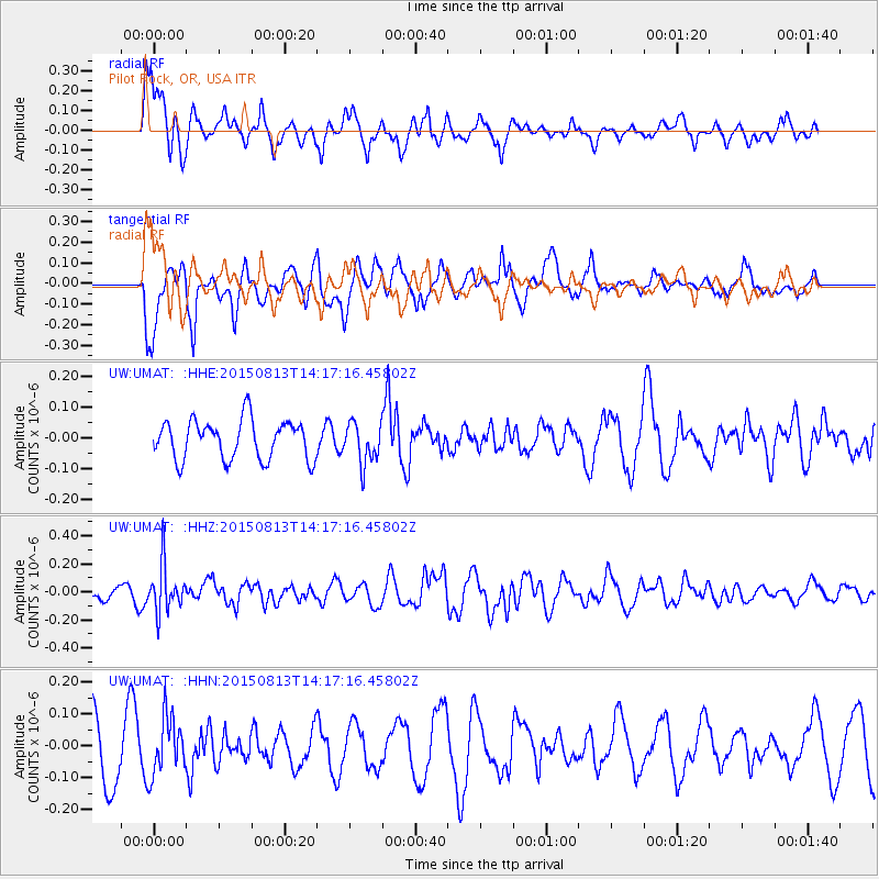
UMAT Pilot Rock, OR, USA - Earthquake Result Viewer
*The percent match for this event was below the threshold and hence no stack was calculated.
| Earthquake location: |
New Ireland Region, P.N.G. |
| Earthquake latitude/longitude: |
-3.9/152.9 |
| Earthquake time(UTC): |
2015/08/13 (225) 14:04:58 GMT |
| Earthquake Depth: |
137 km |
| Earthquake Magnitude: |
5.6 MB |
| Earthquake Catalog/Contributor: |
NEIC PDE/NEIC ALERT |
|
| Network: |
UW Pacific Northwest Regional Seismic Network |
| Station: |
UMAT Pilot Rock, OR, USA |
| Lat/Lon: |
45.29 N/118.96 W |
| Elevation: |
1318 m |
|
| Distance: |
91.5 deg |
| Az: |
44.89 deg |
| Baz: |
265.915 deg |
| Ray Param: |
$rayparam |
*The percent match for this event was below the threshold and hence was not used in the summary stack. |
|
| Radial Match: |
71.54911 % |
| Radial Bump: |
395 |
| Transverse Match: |
63.249905 % |
| Transverse Bump: |
400 |
| SOD ConfigId: |
7422571 |
| Insert Time: |
2019-04-20 09:08:33.672 +0000 |
| GWidth: |
2.5 |
| Max Bumps: |
400 |
| Tol: |
0.001 |
|
Signal To Noise
| Channel | StoN | STA | LTA |
| UW:UMAT: :HHZ:20150813T14:17:16.45802Z | 2.5061624 | 1.6885974E-7 | 6.737781E-8 |
| UW:UMAT: :HHN:20150813T14:17:16.45802Z | 1.0773729 | 8.833986E-8 | 8.199562E-8 |
| UW:UMAT: :HHE:20150813T14:17:16.45802Z | 1.5276256 | 9.7745115E-8 | 6.398499E-8 |
| Arrivals |
| Ps | |
| PpPs | |
| PsPs/PpSs | |


